Member Contributer sckego Posted May 20, 2008 Member Contributer Share Posted May 20, 2008 It's been a while since Vic and I had the opportunity to jump on the bike and go exploring, so when I realized that this weekend was free for us and the weather was supposed to be nice, I started making some plans. I had several options of where to head in mind, and decided on meandering southwest to San Saba, with a visit to Colorado Bend State Park for some hiking and swimming. Here's how the trip went... Day 1 Map! Saturday morning, 8:30 AM. 58 degrees F, forcast high of 85 over the weekend, 10% chance of rain. A bit nippy, but otherwise just about perfect weather. We're packing up the hibachi and Vic asks if we're going to bring the rainsuits... "Nah, it's not going to rain." We gear up and get on the road! The clouds are light and fluffy and make cool reflections in my helmet as we run down 360 to 157, then cut westward across Lake Whitney. Then through Clifton and Cranfill’s Gap for some of the really fun stuff… Passed a local standing on the side of the road just outside of Cranfill’s. The clouds started to darken as we turned south for Hamilton. Vic playing peek-a-boo in front of the Hamilton courthouse… We walked across the street to a neat little drugstore. The signs on the storefront read: “Antiques, Old Tyme Remedies, Soda Fountain, Unique Gifts, Bridal Registry, Rx Compunding.” Vic was intrigued. We got some ice cream (it was pretty warm by this time), and Vic decided to try the ‘cherry limeade phosphate’ that the guy behind the counter described as the equivalent to soda back in the ‘50s. It was quite tart, but kind of tasty once you got past the initial bite. Vic also commented that the packaged dill pickles (on the rack to her right) looked tasty, and the guy looked at me and said “Hmmm, ice cream and pickles? That’s not a good combination, sir…” and then proceeded to tell us which aisle the prego tests were on! We walked out of the drugstore and Vic asks, “So you’re sure it’s not going to rain?” No, it won’t. I’m confident. We arrived in San Saba at about 2:30. The plan was to check in to our room at Burnham’s Lodging, head down to Colorado Bend for the afternoon, then head back north Sunday morning. However, Vic was quite bushed (we’d stayed up kinda late the night before), so she wanted to lay down and take a nap. We decided to just hang around in town for the rest of the day, then do the park the next morning. While Vic was sleeping, I wanted to get a quick snack, so I walked over to a crawfish boil fundraiser that was taking place in front of the courthouse. $5 for a 1’x2’x4” cardboard box filled with 8 or 10 pounds of boiled crawfish, corn on the cob, grilled onion, etc. Durr… Me: “I just wanted a snack, man!” Crawfish Boilin’ Fellow: “Well that’s what you’re getting! $5 more and it’s all you can eat!” So what can I do? I sat down, started chatting with a guy from Houston, and started eating. An hour later… “Uhhh… I’m kinda full…” Yep, I ate the whole box. I wish I had a picture—I left the camera in the room. Doh! After I’d had a chance to let my stomach settle, I woke Vic and we headed out of town a bit to go exploring. The clouds were still looking dark and threatening. Vic looks at me: “You SURE it’s not gonna rain?” I’m less confident now, but still believe… “Nah, it’s not gonna rain.” Our first stop is a tree called the ‘Wedding Oak,’ as it was the site of many Indian marriages, and the early settlers kept up the tradition—the historical marker said that on Christmas Eve of 1911 three weddings were held there in one day. As we pulled up to it, the drizzles started. No, it’s not RAIN, just drizzle. Dammit. We took shelter under the massive tree anyway. After a few minutes, the rai-DRIZZLE lets up, and we continued on our way. Next stop was one of the oldest suspension bridges in Texas, the Beveridge Bridge, built in 1896. It was fun to jump up and down on it and watch Vic get green in the face. Still drizzling. We decided to head back into town and find some food before the precipitation got any worse. So much for wishful thinking, right? We had barely gotten back on the road when I was forced to admit that yes, it was raining. And before long, pouring. We made it back to our place in San Saba in just a few minutes, but enough time to soak our jeans and dampen our shoes. Luckily we were both wearing our Cortech jackets which keep the rain out decently well. Unfortunately, because it WASN’T GOING TO RAIN on our trip, we neglected to pack extra pants. So, after a hot shower to warm up, we had to get back in our damp, cold jeans to go find dinner. At least it stopped raining. Grrr. Link to comment Share on other sites More sharing options...
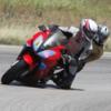
Member Contributer sckego Posted May 20, 2008 Author Member Contributer Share Posted May 20, 2008 Day 2 Map! One of the odd things about Burnham’s is that the rooms don’t have windows, so it’s very easy to sleep in late thinking the world is still dark outside. I finally rolled out of bed at about 7:30 and checked the peephole—it was beautiful and sunny outside! I rousted Vic from her sleep and we packed up and got going. Our jeans and shoes had pretty much dried overnight too, which was a good thing considering it was a bit chilly. Doesn’t look like much of a place, does it? Rooms are surprisingly nice, especially compared to the impression you get from the exterior. And it’s right on the town square. Vic was proud that she scored a shot of the courthouse while we were moving. Heading into the sun along 190… the weather was cool, a bit below 60, but the sun felt wonderful. It was one of those perfect mornings where everything just feels right, when you couldn’t be happier then to just be motorcycling down the road. My first attempt at taking a picture while riding. I think it came out pretty well! FM 580 heading southeast towards Colorado Bend was a great road; lots of nice sweepers accompanied by beautiful scenery. While pulling a U-turn to get this shot, I leaned it over a bit to far and nearly dropped the bike. The engine was banging off of the rev limiter while I was trying to wrestle it back upright, which I did successfully after a few seconds. I turned around to ask Vic if she was OK and she was giggling—she thought it was quite funny that we nearly fell over in the middle of the road. Aiya. We came across a high-water crossing on the way into the park. It looked very inviting, but it was still too cold to go for a swim. Can you find the turtle? The road into the park was degrading slowly, until it finally turned into just a straight gravel road. The gravel bit was probably about 8 miles long to get to the park headquarters down by the river. Some of it was nice and hardpacked with just a few loose stones on the surface, and I was able to keep it around 30mph… most of it was kinda deep and loose, and I had to drop to 10-15mph. It took us quite a while to get to the end of the road. They were kind enough to pave the very steep section that dropped down to the river at the very end. We did a short hike (<1 mi) to a cascading spring. It looked very nice, but it was still too cool to jump in… We also saw some natives on the walk back to the bike. Our next hike was a bit longer, about 4 miles roundtrip to Gorman Falls. The first part of the hike was along a gravel road (I was quite tempted to weave the bike around the gate and just ride it), and it was getting warmer. However, we soon started descending down through the brush, and the shade kept us nice and cool. Vic said the scenery reminded her of home (California). We finally reached the falls at the bottom, and sat down for a snack. The environment was quite a drastic departure from what we’d been hiking through… it was very cool from the falls’ mist, and there were lush ferns everywhere. It was also finally warm enough to jump in the water… but, everything was a ‘fragile protected area’ or something and I couldn’t. I still nearly did, though. On the walk back up I wished I had. We stopped in Bend on the way out of the park to refill our water, then got back on the road for our trip home at about noon thirty. It was really getting pretty warm… didn’t feel like 85 degrees, but whatever. We saw a bunch of African imports along 581. We passed through Lometa, and left down on FM2942 heading north, which should have connected us back to 1047. However, we discovered 2942 kind of peters out several miles north of Lometa. We tried venturing down several of the county roads in the area, but they kept just turning into gravel. We eventually gave up and headed back to Lometa to pick up 581 there. Note to self: Google Maps is not always accurate! As we were riding north on 1047, it occurred to me that this was the same road we came south on for our Hill Country trip last August. I decided to stop for a picture at the top of a certain hill… Sunday morning, heading north: Sometime last August, heading south: We had lunch at a little home-cooking café in Star, then zipped through Hamilton and picked up 22 through Cranfill’s Gap to Meridian, where we stopped for a short rest. The bank sign across the street read 94 Fahrenheit. High of 85 my ass. I should’ve jumped in that waterfall. In Cleburne, we pulled off at a Sonic for some ice cream. Look, Vic, ice cream! Ooh, brain freeze. I had the mother of all brain farts leaving Cleburne… heading north out of town, I could see the highway interchange up ahead maybe a quarter mile. I glanced down to check our route and see where I should be headed… when I looked back up, there was a split second when I wondered why all the oncoming cars were stopping… then I realized that I was about to pass under a red light at about 45mph. Err. I grabbed the brakes for an instant, but there was no way I was going to stop. There was a car coming out of the cross street to my right, so I gave it more gas and weaved left across the intersection. Luckily the car was on his brakes already, having seen me and figuring I wasn’t going to stop. Whew. Got lucky that time, but remember to always watch for ignorant cagers who just blow through green lights without checking for red-light-running motorcycles! They’re everywhere out there! A bit of superslab later and we were back home… not the most perfect trip ever (It’s not gonna rain!), but fun nonetheless. Now lets get inside the air conditioned apartment! Link to comment Share on other sites More sharing options...
Member Contributer Rivcyko Posted May 20, 2008 Member Contributer Share Posted May 20, 2008 LOL. Cool. If I don't move to N.C., I'm coming your way. Love the ice cream pic. LOL. BRAIN FREEZE! Link to comment Share on other sites More sharing options...
Guest Posted May 21, 2008 Share Posted May 21, 2008 Excellent post and pics! Thanks for sharing. Get Vic a bike of her own. I know it can be tiring with someone on the back of the bike for long periods of time. It's great you got someone to share the journey with too! Link to comment Share on other sites More sharing options...
Forum CEO HispanicSlammer Posted May 21, 2008 Forum CEO Share Posted May 21, 2008 Enjoyed this post moved to feature on the homepage Link to comment Share on other sites More sharing options...
vfr_steve Posted May 21, 2008 Share Posted May 21, 2008 Great trip report, haha that last pic... seen that expression many times before Link to comment Share on other sites More sharing options...
Member Contributer dutchinterceptor Posted May 21, 2008 Member Contributer Share Posted May 21, 2008 219 is a fun road for sure. Another job well done on the report! :fing02: Link to comment Share on other sites More sharing options...
Member Contributer Bent Posted May 22, 2008 Member Contributer Share Posted May 22, 2008 Nice. Be glad you don't have to spend time in Gatesville......maximum security prisons there ya know..... :fing02: Been in most of that country. It's easy to get in the middle of nowhere quick. Used to live in Keller. :fing02: Link to comment Share on other sites More sharing options...
mick Posted May 22, 2008 Share Posted May 22, 2008 Nice. Be glad you don't have to spend time in Gatesville But if you do and you ever want to leave, be sure and take that little road on your Viffer that runs between Gatesville and Crawford! Link to comment Share on other sites More sharing options...
mick Posted May 22, 2008 Share Posted May 22, 2008 It's been a while since Vic and I had the opportunity to jump on the bike and go exploring There is actually a lot to explore, especially to the west and southwest of Fort Worth. I do a swing up through N. Texas about twice a year on the The Yeller One (grew up in FW). I've found some really great roads. Below are just a few: 1. Hwy 4 between Graham and Granbury, especially the part between Palo Pinto and Santo. This is the Possum Kingdom area. 2. Hwy 207 between Breckenridge and Strawn - very much like the Hill Country west of San Antonio but with a little more vegetation. Then, take the road that goes from just outside of Strawn to Lake Palo Pinto. 3. Hwy 1602 between Hico and Jonesboro. Lots 'o curves and really beautiful scenery during the spring. 4. 1702 between Dublin and Goldthwaite. Lots of great roads and scenery. 5. Lake Brownwood area just north of Brownwood - Hwys 2273/P15. Here's a pic of just one of the many interesting things that await you when you explore the little nooks & crannys of north central Texas. I think it's an abandoned school just outside of Indian Gap, TX. It might also be an old train station as there were some abandoned tracks in the field nearby. This is from a trip I took in 2005 on my old '99 (gone but not forgotten): And here is a sign proclaiming the geographic center of Texas on hwy 84 between Brady & Brownwood: Heck, you can even see the world while you're traveling around. Here's a pic of beautiful London, Texas: Link to comment Share on other sites More sharing options...
Member Contributer meddle1999 Posted May 22, 2008 Member Contributer Share Posted May 22, 2008 Great post,great pics... nice!!!! Link to comment Share on other sites More sharing options...
superfunkomatic Posted May 22, 2008 Share Posted May 22, 2008 great post, you're a good ambassador for the state of texas. your pictures show it is far more scenic than i'd expected. and yes, 95 is a bit warm for sitting on a bike. thanx for sharing. Link to comment Share on other sites More sharing options...
Member Contributer Dutchy Posted May 23, 2008 Member Contributer Share Posted May 23, 2008 Great report and pictures :fing02: Looked up Texas on a map.... MASSIVE!!! (compared to the Netherlands...) Link to comment Share on other sites More sharing options...
Member Contributer skuuter Posted May 23, 2008 Member Contributer Share Posted May 23, 2008 Another great Trip Write-up and Pictures from you.....always enjoyable.......THANKS............... :fing02: :beer: Link to comment Share on other sites More sharing options...
Guest Posted May 26, 2008 Share Posted May 26, 2008 Very Nice!!! :rolleyes: Link to comment Share on other sites More sharing options...

Recommended Posts
Archived
This topic is now archived and is closed to further replies.