Member Contributer BonusVFR Posted July 12, 2008 Member Contributer Share Posted July 12, 2008 For the last couple of years in between MC tours with the guys, I have sort of combined family vacations and VFR days. Using my Silverado, also called a “what is that grey box by some distinguished moderators”, I have remained the perfect husband while having the opportunity to sneak off for some VFR moments on some of the best roads in the United States. This year my planned sojourns in Northern California, specifically a return to RT 36 and 3, were axed due to this ……………Hot! Courtesy of Cal Fire! But this only points to the flexibility of this kind of tour???????? Plus I did not need an iron lung when I got back. I was able to manage rides on both Ebbetts (Sierras again) and Stevens Pass (Cascades) while bolstering my marriage. Actually more but who is counting. What feelings………..What a guy! Plus I was able to test some new Gizmos for my Zumo and try out my Roadsmarts as well. Just over the top …………Ebbetts Pass Ebbetts Pass next and don't ask about gas prices! Link to comment Share on other sites More sharing options...
Member Contributer BonusVFR Posted July 13, 2008 Author Member Contributer Share Posted July 13, 2008 Our first truck stop on the way North to the Cascades was Motown, better known as Modesto. The next day while my bride was visiting her Uncle and Aunt I flew/VFRed the coop. Over the last couple of years I have been over all the major Sierra Passes on my VFR or Wing with the exception of the Ebbetts pass or RT4. Leaving from lovely Modesto, I had hoped to travel East over Ebbetts and return West over the Monitor and Sonora Passes. Alternatively you could cross over the Carson Pass to the North and perhaps sample Tahoe. The return over 108 was a loop of about 300 miles and more if I stopped in Markleeville. This required an early start, which was not possible due to the command performance family breakfast ………..oh well I had ridden over the Monitor and Sonora Passes and camped near Markleville in 2006. Ebbetts is usually is one of the first high Sierra Passes to open in the spring and last to close. Check out Caltrans first before you plan any Sierra Trip. http://www.dot.ca.gov/hq/roadinfo/clsdlst.htm Rt 4 with the Sonora and Carson Passes to the South and North respectively. As you hit the foothills of the Sierras you ride on some of the most amazing terrain i.e. rolling golden hills, live oaks and open vistas with lots of beautiful corners. These rollers and sweepers are a magnificent preamble to the high mountains ahead and a wonderful ride in its own right to see the spring flowers before the passes open. On the Intersection of RT4 and RT49 at Angels Camp you can take a break and enjoy another Gold Rush town. Quaint little villages like this do not exist on the Eastern Sierra so enjoy but 49 is loaded with them. The first couple of miles really are nothing special till you reach the Calveras Big Trees State Park. I camped here once on a biking tour of the Sierras…………ugh! VFR climbs better. I wonder where they get the Name. Note my Y2k mirrors courtesy of ar errrrrrrrrrrrr remodeling incident in the garage. The last hint of traffic is pretty much gone after Big Trees and road for most case is one continuous corner. The West side of the Sierras generally does not climb as steeply as the Eastern transits. This is especially true for RT4 as there is also a false summit of Pacific Grade which also has a steep downhill section on the East side. You drop over a 1,000 ft in a little over two miles. Not sure why I like this shot but I do – at an overlook just prior to Bear Valley Bear Valley Village has gas, food and is one of the only flat stretches on the whole trip. False Summit of Pacific Grade and Mosquito Lake ............which is as gorgeous an alpine lake as you could imagine. The road then tightens and plunges downhill and is also quite a bit narrower. I had some serious health concerns on this section years ago on a tandem bicycle with my poor son. There is a small valley and campground at the bottom before the last climb of about 2,000 ft to the summit of Ebbetts. Again the road over the top drops precipitously towards Markleeville at RT89 at the bottom. Beautiful Lake just over the top of Ebbetts Pass I was running out of time as I had loitered on several overlooks but not had time for gas or chow so back to 90+ temps and Modesto, Family and dual tasking. As a side note, this is where the Zumo really pays off as I was able to do a couple of quick ETA comparisons of a direct return route to my wife/family or continuing on my original route. The Zumo needs a Marital Harmony routing option as well as shortest distance and least time……..but it would be a hard algorithm to write as it is mood dependent and also depends on your relative performance as well. So long Major Ebbetts.........they should have made him a Colonel. Heading West again and remarkably clear considering the 1300 California fires that were burning at the time. Link to comment Share on other sites More sharing options...
ShayneJack Posted July 14, 2008 Share Posted July 14, 2008 Great ride report, very nice pics... :fing02: Link to comment Share on other sites More sharing options...
Member Contributer AvalonRacing Posted July 14, 2008 Member Contributer Share Posted July 14, 2008 Cool! I'm not the only one with a red 5th gen and a matching red Specialized MTB. Link to comment Share on other sites More sharing options...
Member Contributer BonusVFR Posted July 14, 2008 Author Member Contributer Share Posted July 14, 2008 Cool! I'm not the only one with a red 5th gen and a matching red Specialized MTB. Yea I even managed a couple of rides on the Sworks too. I always feel stronger on the VFR...........maybe it is all mental?????????? Link to comment Share on other sites More sharing options...
Member Contributer BonusVFR Posted July 14, 2008 Author Member Contributer Share Posted July 14, 2008 Running down RT4 was just as much fun and I often find that I miss a lot on the way up cause I just don’t look over my shoulder. Our VFR mate, Sebspeed, has a fantastic shot of 191 in Arizona that I completely missed and I hate to keep borrowing it as the licensing fees are so steep…………….kinda like the road. Returning on RT 4 I missed a few photos of bicyclists topping Ebbetts from the East the steeper section. I climbed it once from the West on my Trek. These riders must have been training for the annual Markleeville Death ride held mid July. The route of 129 miles and 15K of climbing pretty well sums it up. As I had some time to play with after a rapid descent, I elected to turn south of RT 49 instead of following the more direct RT 4 to the valley. RT 49 can be busy but it is great road. I did not ride my favorite sections this time but ………….you have to ride from Coulterville to Bear Valley on the southern portion and from Nevada City to Sierraville with a stop in Downieville further north. Old tour shot of the first section........ New Malones Lake – levels are down after two lean snow years in the Sierras. The Zumo auto routed to Rawhide Rd. Now who would take a road like that unless you were on a Dual Sport? I touched the I believe button on my Zumo and turned right and saved about 10 miles and bypassed downtown Sonora. This 49er town is delightful but sometimes congested and I was already pressed. Never ever would have done this before GPS, as I had no idea about this road. Follow my tracks. I will probably use this cutoff again - save the tracks for another day. I was starting to get concerned as my gas gauge was flashing reserve with 232 on the odometer. And sports cars were screwing with me.............that hurts. I was pretty much going to make it to Modesto right on time as promised if I did not stop for gas. Thirteen more miles to destination does not seem lucky to me does it?? The Zumo gas gauge was on high alert too. I did a quick stop as there was another family event planned and better late than REALLY sorry. I probably would have JUST made it and set a new record of 245 miles on odometer, turns out I was averaging 45mpg on this loop. My tank record is 242, but I just did not have the b……………………lls this time. I only put in a gallon because when truck/VFring, I like to load the VFR with the tank almost empty as ……………well stuff happens sometime and extra weight is not that your friend. Plus I was not sure who was going to help put the critter back in the truck Down the road from Stevens Pass in the Cascades for my next mountain pass adventure. Link to comment Share on other sites More sharing options...
Member Contributer BonusVFR Posted July 15, 2008 Author Member Contributer Share Posted July 15, 2008 Some of the best roads in California are just off Interstate 5 in Northern California when you reach Red Bluff. Rt36, 299, 3, 96 are just west of the freeway and Lassen and a host of treats are to the East. However with 1,400 fires reported at the time, I joined my wife in the truck and we relayed our feelings and discussed the great shopping (sure) we were going to do. And the AC in the truck is even better than the unit on my Wing. Basically visibility and air quality sucked North of Sacramento all the way to Medford Oregon. Did I mention it was hot? The next day, we did some sightseeing in the Rogue River area on the way to the Oregon coast and clear/clean air. VFR still secure! More on truck hauling later. Lots of rain in the Northwest this year….like the flowers honey?? What the Hell………gate is that that Link to comment Share on other sites More sharing options...
timmythecop Posted July 15, 2008 Share Posted July 15, 2008 Great stuff. You found a way to make it work. Most times, my wife lets me do one better and ride to our destination. (but I think that is wearing thin) Great photos. Link to comment Share on other sites More sharing options...
Member Contributer BonusVFR Posted July 15, 2008 Author Member Contributer Share Posted July 15, 2008 Great stuff. You found a way to make it work.Most times, my wife lets me do one better and ride to our destination. (but I think that is wearing thin) Great photos. It is all about balance and wearing toooooooooooo much. Raw does not work for anybody. Most of our long distance vehicle travel means either I drive thru LA and by way of the California and Arizona Deserts. Not so bad to be in the truck really as neither of these environments are what you call MC friendly be it a VFR or a Wing. Suprisingly I find that my truck gets about the same mileage whether I am hauling or not. However, towing the trailer/Wing cuts the mileage about 2/3 mpg. Link to comment Share on other sites More sharing options...
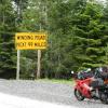
Member Contributer BonusVFR Posted July 15, 2008 Author Member Contributer Share Posted July 15, 2008 The special VFR portion of the Independence Day show in tiny Skykomish – our destination for the weekend. Great to be an American! Our cabin on the Skykomish River. The next day I tried out the Cascade Loop A counterclockwise loop from Skykomish via Stevens Pass on Rt 2 to Wenatchee to 97A/Lake Chelan and then on to RT 20. Depending on detours this could be 400 miles. We will see and another family performance that evening??? And looks like no early starts this year. Gentle climb to the top where it turned wet. Lots of traffic on the long weekend. It was July 4th though and these folks up here really savor the outdoor life. Looking up from RT 2 on the way to Stevens pass. Very steep mountains surround this valley! Unlike Southern California the Jet stream pumped above average moisture to the Northwest – way above average I hear. A typical year East of Seattle brings 100 + inches rains plus 60 inches of snow. Rain every other day – Green is what it is. Typically the clouds begin to stack up as the road and the river climb up the valley. The top is about 4,000 ft. Damp! In San Diego I don’t ride in the rain as it would be like a native skiing on a cloudy day at Alta. I felt ok and the new Dunlops seemed fine. I had my touring Stich so I was dry, by the time I thought about turning on the grips I was over the top and the weather started to clear. On the back side the Wenatchee River was boiling. On the East and mostly dry side, you ride through Leavenworth which is kind of neat if you like trinkets and mementoes and theme villages…………I don’t. A place to take your wife…………I did later in the week. :goofy: Also took a little detour on another ride South of Leavenworth. Turning North on 97A along the river was ok but encouraged velocity during passes. I decided to detour to a buddy’s house in Lake Chelan. This just about ruined any chance of making the loop. On the scenic approach, I saw my third RoadK of the day. Be careful out there. Yes it is scenic and third deepest lake in the US. Crater, Tahoe and Lake Chelan and now I have been to all three on MC tours. The View from his backyard is just so so though. What can I say……..He likes toys. Bought my Wing used with 3k from him. He had to get the K1200S or was it the MV Agusta……….I forget. After being fed and hydrated, I decided to head back West and do the entire loop next time. To be honest, I was a little spooked as I guess RT20/153 is really deer country with signs telling how many vehicle strikes so far this year. FYI, there are about 1.5 million deer-vehicle collisions with 150 deaths each year in the United States, according to the National Highway Traffic Safety Administration. Back to the Colombia River Looking west while going thru Leavenworth.........something is brewing. Really there is not much civilization after this till you get to Goldbar/Sultan on RT2. The weather gave a repeat performance on the way back to Stevens Pass. For sure it was wet and cold going up and over to the Seattle side. On the way back, I scythed through slews of Harley ……most were Glides and Road King baggers rather than the simpler models down south in San Diego. Not many r..rockets either. Why do they need more weather protection up here …I wonder? I did not see any random digits in the air so I must have been mature. A couple of days later I went over the top in the sunshine. Total trip length was again about 250 miles which seemed a good balance between family, friends and riding. All in all a great ride and you have to love the mountains. Rivers, Lakes, twisty roads, cool temps and fantastic overlooks. After the weekend, I trucked over to Wenatchee to stay for a few days and did some more riding. Have to go back!! Link to comment Share on other sites More sharing options...

Recommended Posts
Archived
This topic is now archived and is closed to further replies.