

BonusVFR
-
Posts
2,104 -
Joined
-
Last visited
-
Days Won
7
Content Type
Forums
Profiles
Gallery
Blogs
Downloads
Events
Posts posted by BonusVFR
-
-
After reading many threads, I opted for these JVC earbuds till I get a permanent solution to getting the sound from my Zumo on the VFR.

They are inexpensive and comfortable. We will see if I can handle them for a full day on the road. As regards Music quality that remains to be seen.
Embarking on another CA tour and test of the Zumo.
-
Local routes update
Of late I have been using my Zumo even on local routes that I know well. For some reason I have been meeting up with other riders for breakfast etc, miles away from my home.

Essentially I have been plugging in the destination town direct on the Zumo and getting a rough ETA so that I know if I have to add/reduce speed to make it on time. Very Handy!
ETA only good if you are on route

However if you have the Recalcualtion off (which is my default position near home) and you do not follow the recommended route your ETA goes to hell quickly and can be very misleading.
It is set on Auto here but when local I select OFF.

This is what the route looks like when you are doing your own thing and not recalculating.

Tip of the day - when you are on the road you want, just touch Detour to got an updated route and accurate ETA to your destination.
And then :rolleyes: because you are probably running late. <_<
Stop and Detour Navigation functions.

-
Well after reading the earbud mods described above (thanks Silver) I decided on a tunes test with my current VFR setup.
Another great ride day in San Diego :thumbsup: - a few CRs out after breakfast including a 1098.

I parked to the side and you can just make out the Zumo.

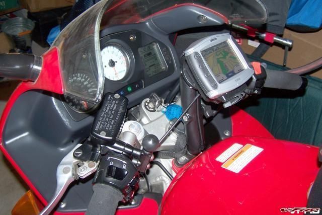
First here is a shot of my preferred mount setup. Center RAM ball with med arm. I have a mini sized tank bag in this shot. And sorry about the tank bag strap – but you get the idea.

This is about how it would look from the cockpit – the angle I mean. I don’t have telephoto eyes any more though.

I tried my IMC headset with earplugs and my MP3 earbuds.
I have MP3 earbuds plugged in here.

Note - keep the RAM lock/adjuster on the left side for emergency tightening (real important if you have a HD).
Heretofore with the VFR, I have focused primarily on the quality of the Navigation prompts. This time I tested the Zumo/headset MP3 capabilities.
I picked the most demanding tracks (highs, lows, whispers, booming male/female voice and sound tracks) I have. The songs are from the Phantom of the Opera soundtrack.
My IMC headset with earplugs did not cut it. However, this set is designed primarily to support my FRS/GMRS radio system. I did not adjust/move my speakers in my Arai Corsair. I just did not have enough vol with the earplugs in to pick up the whispers/soft voices on the track. The earbuds worked great but I am worried about comfort when I ride for the full day.
The bottom line – the search is on for my VFR speaker/earbud system. The Wing's Zumo tunes are fantastic but I do not ride with earplugs on the big guy, have a separate amp, and the speakers are high quality and better placed.
Any recommendations? I am trying to get feedback from Edsets users but may opt for comfortable earbuds as an interim solution.
-
For the moment on the VFR, I use an IMC headset which plugs into the 3.5 mm Zumo output just fine. "No cell transmit though......"
Hey BonusVFR go see what you made me do :joystick: My zumo now works fine with my bluetooth cell phone.
I don't need to spend any more money!
Yours looks like an economical solution that works. Gets me to thinking!!!
I am still deciding what I am going to do on the VFR with the cell transmit.
Do something piecemeal and inexpensively or spend big $$$ and look at the big picture and integrate all the toys, RD, bike to bike radio, and Zumo into one package. I have the integration capability on the Wing but I also had a lot to start with.
Now for my pet MC peeve. :pissed: Of course as those of you have experimented know, none of the various speaker, amps, intercoms or for that matter anything are standardized so one set of speakers/mic/acc cords are not likely to work with another system. They don't even work if you are talking about plugging into a standarized 5 pin intercom/audio jack like on the Goldwing. I don't think there is lower headset cord that connects to the Wing audio, that will work with another manufacturers headset.
And another thing, if you do something practical like you did and then add another device, you are back to the drawing board.
I spent weeks investigating wiring up my FRS/GMRS radios to both of my bikes and I swear there is not a single radio with the same plug. 3.5mm, 2.5, 2.5 motorola, dual plug and on and on!
This is very frustrating and I am starting to get upset - have to ride now! <_<
May have to start another Tales of the ........... thread.
-
Recalculating the Route
As I mentioned in my earlier posts when the Zumo was released there were many GPS purists/experienced, who were concerned that with the Zumo, you could not turn off/modify the automated features. The primary concern was with the automatic recalculation of routes when you strayed off course.
Specifically they found the voice prompts were annoying and that your whole route would be changed with the recalculation.
My experience with whole recalculation process in general has been that the Zumo directs you back to the original route and the next via point but others have complained that the whole route is dumped.
Here I am off route and being directed back to the route route/waypoint.

I suspect the whole route would blow up eventually, if you kept ignoring the prompts and headed off stubbornly to find a new life. But there must be a thousand different permutations of how you could screw up the route and ways the Zumo could respond. I have only tested the 781 but can not wait to test the 1,000. :wheel:
Now some more background. What the Recalculation feature does ...............when you stray off course the Zumo immediately starts figuring a way to get you back on the route. This happens very quickly. There are several likely scenarios here:
1. You screwed up, are hopelessly lost and you welcome Jill’s assistance.
2. You deliberately took a detour (gas, break, lunch, view etc) but welcome the assistance to get back on route as you are in an unfamiliar place on tour. After all you would never stop to ask – right!
3. And a third situation when you get off the route intentionally, know where you are and start feeling like ….Well being nagged for instance. :offtopic: Apparently in some males this initiates an irritating auto response mechanism that some females consider unpleasant if not rude. Frustration builds. And you want to shut the bi……… up.
First off, for the record, I never personally exhibit the immature and definitely short sighted attributes outlined above, but I have heard of guys who are like that but they mostly ride ……………. :rolleyes:
Well Zumo handled all three scenarios quite well even before the latest firmware update (3.3). In the first two scenarios, the Zumo goes with the flow. In the third, the Zumo operator can just touch STOP on the main screen and Jill shuts up. The GPS is still working and you still know where you are but no route is programmed.
I have used STOP a few times in lieu of shouting “SHUT UPâ€.
However, when you do that your route is not to be found on the screen – so it looks like this.

If you wanted your route back it was easy to load it again.
If first prompts you to whether you want to go back to the beginning of the route. The answer is up to you. But I would hate to start all over again.

You may see something like this when you are on route.
Beginning selected route

Not good enough so you need more features then? Here is what ver 3.3 did for us.
The new software update now gives you more flexibility with regard to the recalculation feature.
The Auto feature works pretty much the way the Zumo worked before and is the default setup

Now besides the Auto function they have added two more options: Prompted and Off
Here I have selected the Prompted recalculation mode. That is each time I stray off course it/she asks me if I want help.

With the Prompted selection when you stray off route you get this.

If you say Yes, Jill starts talking. If you select NO - silence. If only that would work in other parts of your life.
Here is what it looks like when you touch NO. Note you can see your route and where you are in relation to it.
When you turn the recalculation OFF, Jill shuts up but you can see the route on the screen (might have to change scale though) but Jill pipes up again when you return to your route for the next planned turn.
The Recalculation features and capabilities appear to be robust at this time. After all that for the moment, I think I will leave the default setup. :blink:
-
Archiving trip logs and displaying logs <_<
About the second day on the road the Zumo starts archiving the trip log. The active log always contains the most recent tracks and the archive files are stuffed into a directory on the Zumo automatically.
Warning if you have not saved that trip segment that you adored to a route by the time the archiving starts you will have to wait till you get back home unless you have a trunk for your PC.
I do ---- but I have the refrigerator in there right now.

Also remember, you can not show any of the tracks that are on the archive files on your Zumo just the active log tracks.
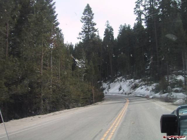
As an example on my April trip to Southern Sierras of 1,350 miles, I had 2 archive files plus the active log for 4 big days of riding (for me). The archive files are called 1.gpx, 2.gpx and so on. They are located on the Zumo itself in the Garmin directory then GPX and finally the Archive sub dir.
One of the bugs in the Zumo software that version 3.3 corrected was that some of the segments in the track log were missing. I lost about 150 miles out of my 1,350 trip for example. Not a problem any more though with version 3.3. Again well done to Garmin, they have really stepped up to improve this unit.
Note - both of my Sierra Trips are on advrider.com (one VFR and one Wing ride). My AZ trip is there too. Both of these VFR rides prompted (see recalc thread soon ha ha) me to get a GPS.
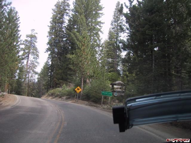
I shot this picture just as we missed our turn out of Sierraville to 89. Was that a right Jill? You had to be there I guess.
http://www.advrider.com/forums/showthread.php?t=217076
http://www.advrider.com/forums/showthread....hlight=hannagan
Typically the archive files contain up to 10,000 track points and are about 1,000kb in size. The Zumo can hold about 20 archive files. So ……..that means at least 3 weeks maybe a month or about two fortnights on the road before you max out the archive and active file storage capacity. That is provided you cleared your logs first before the trip started.
As a side note, unlike some other units the number of log points and for that matter how the segments are determined is entirely driven by the Garmin algorithm. Again this is a completely hands off function – the secret sauce again. Obviously if you turn off your Zumo a segment will end but it may also if you park alongside the road and leave the unit on battery.
Never mind really as you can combine various segments in MapSource later if you like. In fact by simply copying the track files from on archive file to a master trip file you can combine all of the active and archive tracks on one MapSource file.
I recommend at that point you delete all the 'crap' tracks like when you put your Zumo in your pocket while you moved into the woods for some privacy to save a tree or some endangered species of CA rat. Do you really need the track for this?

Here are the individual track points from a segment. All kinds of info here: Time; leg length, time, speed and course; as well as position for each point in the segment. There is also meta data on each segment.

Elevation Profiles are available too.

When you link with MapSource and use the “Receive from Unit†only the active logs are downloaded into MapSource. Now that you know where the archive logs are you can retrieve them manually. Keep in mind unlike the active log there are no waypoints or routes available on these archive files just tracks.
BTW - If you look carefully, the Zumo active log is contained in the Current.GPX file in the GPX directory on the Garmin Unit – not the SD card. The Current file contains a great deal more as well including favorites, routes etc. These files are also downloaded with you link up using the Mapsource link buttons. FYI, the other GPX file is the Temp.GPX which contains the active route on the Zumo. But don’t fool with either GPX file on the Zumo itself as you download the info automatically to MapSource when you use the MapSource link buttons. You would hate to screw up all your Favorites!
The actual track logs from both the active and archive files have identical information. You can display them in Mapsource.
You can see each log point on this file. When you start turning, Zumo starts adding more points to pin down your exact location.

Note that a track may be rougher looking than a route as each point is connected by a line which may look like you are missing a few apexes or no rhythm.
Then you can roll the tracks and/or routes into Google Earth

For more info - there are "How to Guides" on the Zumo forum. Although I am not sure this bit is in there.
http://www.zumoforums.com/zumo/viewtopic.p...asc&start=0
Next Up the "Recalculating the Route"
-
Ok, now let us expand a little on Zumo Trip Logs
Previously, I talked briefly about the trip log capabilities of the Zumo. To review Tracks are what you actually did and routes are what you plan to do. The routes are what is/are preloaded into the Zumo by using Mapsource or by direct input through the Zumo “Where to†interface. If you are good and have the perfect plan your routes will be the same as your tracks.
This is how adept I am. Here, I am diverting around a closed gate at Huntington Lake in California. This is why I like tracks so I can figure out or remind myself what I really did.
I have found the tracks very useful as rarely do all my routes actually pan out as I had planned. Stuff happens! Plus they are great for reconstructing your trips/reports and to pinpoint exactly where took that photo (V4 Rosso pointed that out earlier).
The Zumo track log feature is fully automatic and you do not need to do anything to activate it. Please be aware, this includes when you are playing around with it in the garage or in a restaurant modifying/rescuing your trip. Every time, you turn the unit on the tracks are building and this screwing around does add a bit of clutter when you download the tracks later.
There are two type of logs/tracks stored on the Zumo. They are the active trip log and archive logs. First the active log:
The active log on the Zumo stores a couple of days of riding or many moments of fooling with the buttons. This log is what is automatically downloaded to Mapsource once you “Receive from Device†or link to the Zumo via USB. Track logs are loaded into the Track tab in Mapsource. The tracks are divided into segments which may include trips from hundreds of miles to a few feet (you turn on the Zumo to locate a beverage establishment while you walk around your hotel/dump room).
Here is a shot of my track logs from my recent Southern Sierra trip. All the tracks are in the left pane and my favorite mountain portion is highlighted on the right.

This is my favorite portion when I am on VFR skis. Sure! I like Mammoth and the Sierras and got their on Zumo power too. :thumbsup:

This unrelated screen shot shows my active trip log (as of today) is about 16% full. The active log holds about 10,000 points of track information and contains many different segments of the same trip.

This is where I also clear my active log and where you save segments of your trip log on the SD card as a route.
There are two things you can only do with the active log and NOT with the archive logs.
1. From the Zumo itself - Save a segment of a trip log as a route on a SD card.
2. Display all your tracks on the Zumo itself.
Before every trip, I clear the active log after I have dowloaded relevant portions to MapSource. That way I can assure myself I can do the two things above on the Zumo from the start of the trip if needed. You may want a log segment saved as a route because it was great and you did not have it on your original route or you want to pass it on to a fellow Zumo user. I also clear the Odometer reading.

Odometer and Trip data resets

To Review what you can show on the Zumo itself:
Show the trip log or make it visible on the Zumo. Maybe you want to retrace it.

Actual track

More on Trip Logs and Archive files :unsure:
-
Well I had another delicious morsel about "working around the Recalc issue" and "Trip Logs" but I will have to defer that because Garmin just blasted another upgrade out today.
Both of the major remaining complaints about the Zumo have been fixed/upgraded.
It is hard to bitch about the Zumo now when it looks like this.

And to think this is where I first saw it - the Zumo I am talking about.
WOW!!!
Changes made from version 3.20 to 3.30:
Added a user selectable Off Route Recalculation Mode
Updated Compass and Trip Computer displays to remember their last page mode
Enabled Bluetooth troubleshooting whenever a phone is paired
Allow volume adjustment when using a Bluetooth headset with audio option set to phone only
Added Lithuanian text language support
Corrected issues in Trip log archive support that resulted in 0 length files and false reporting of full logs
Corrected issue on Compass page that prevented it from displaying the heading
Corrected flashing on the Enter Coordinates page
Corrected issue that allowed the page key to escape from the pin entry for Garmin Lock
Corrected rare issue that could prevent proper startup when custom POI files contain a large number of bitmaps
Corrected problem ejecting on Mac computers
My reviews of the Recalc and Trip logs shortly.
Thanks
-
Route Lessons learned Part two
Now that we are all using some sort of points, here are a few tips to avoid mistakes that I alluded to above.
The key is to really zoom in to make sure you point is on the road otherwise this happens. This illustration shot is by a GPS maestro (Goldwinggadget) who runs an electronic firm supporting GPS stuff mostly for the wing. This happens to be a waypoint.

You see that because the viapoint placement was off the road the route got hosed. You really can not see what you have done if you are planning from 50K Feet.
Another issue I have had is if you mark a particular town to force a route, that town or at least the center of it is often off the road you are traveling. Hence you get minor diversions to hit the geographic or political center of the town. With the waypoint tool in Mapsource the town name will appear before you select it. Could be a problem? If I followed the Zumo to the letter a couple of times I have had to get off the road to hit the point even if it a one horse town.
With S&T it is so easy to hook a town to add to your route. God knows what is going to happen when you transfer it to the Zumo.
Here is what the properties of a shaping point (a via point too) look like if you have it right. :thumbsup:

Note that the Type of point 30 is a Map Intersection and it confirms it in the Comment section by giving the respective roads.
Then Test Routes in your Zumo, before you claim brilliance! <_<
When I was experimenting using a waypoint at an intersection, this is what happened. Obviously my aim was lousy. Be careful.

If you start hearing U-turns you probably screwed up and you better hope you are not in the lead or trying to act smart.
Next a little more about the Recalculation of the Route and Trip logs
-
With regards to Route planning, I have done basically a 180 in my approach since December.
Previously in my posts, I outlined/restated some of the technical procedures used to construct routes, waypoints and shaping points etc. This time, I hope to give you a more conceptual approach to optimizing Zumo routes.
The only lesson learned I have mentioned so far really has been: one route – one day. :thumbsup:
Despite my predilection for S&T and its simplicity and effectiveness, I force myself to use Mapsource to plan my routes. I may use Street and Trips to plan with a broad brush, but not when I get to point of actually downloading a route to the Zumo.
Mapsource and Zumo together just have too many advantages to not use them for route making let alone the replay of the trip.
Initially my routes were a reflection of the way I used the Microsoft product – namely making waypoints/stops to force the route to specific mountain and scenic byways.
Hence when I made a route in Mapsource it looked like this. Note all the locations on the map which correlate with waypoints and ultimately Zumo Flags.

On the Zumo it looks like this – see all the flags which are waypoints or favorites.

Again the ramification of all this is that I would hear Jill all the time telling me stuff which was not critical to where I was going.
AND that was assuming that my waypoints were constructed properly :idea3: ...more on this later...!! <_<
With the old tank bag annotated map, a whole bunch of scribbling/notes is no problem as the human brain just ignores the irrelevant and focuses on what is important for the moment. That is a hell of smoothing algorithm – we should all be proud we have one.
Zumo is not that smart and has to tell you everything even if you do not care – cause it does not know what you mean just what you asked it to do – however unintentionally.
Using Mapsource with shaping Points at street intersections my routes now look more like this

See how the entire portion to the east was constructed without waypoints. I just used shaping points at intersections to make a seamless route.
In sum this is what I do now. I use the route tool and pick the start and end and let the computer have a shot a finding the route based on my preferences set in Mapsource. If I do not like it I use shaping points at intersections to drive the route to what I like. If you use shaping points at particular points as opposed to intersections it has basically the same result as a waypoint. Your via point (waypoint/shaping point) is announced.
Waypoints still have their place i.e. you want to stop at a particular place for lunch/view/pick up a friend, must see venues etc.
Some folks over at the Zumoforums are calling waypoints used solely to drive a route, PONI or Points of No Interest as opposed to the POI databases which are put in the Zumo because they have interest - my Honda dealers for example.
I went from Manual to Auto route making.
Now a word about setting up your preferences. From the new MapSource window, choose 'Edit -> Preferences' and then select the 'Routing' tab. For more scenic routes, it would seem that you should choose 'shorter distance' and set the road type slider more toward 'Prefer Minor Roads'. After all, VFRs are about twisty stuff right.
However if you set the bar too far towards the minor roads you will get on every feeder road in the western hemisphere, which can be a real pain trying to fix.

Trust me you do not need the slider bar all the way to the left to see this in the Southern Sierras...

or this
or this

Imagine you are taking a major road trying to head to the hills – you could get off every exit and parallel on flop house row. :goofy:
Anyway for what it is worth here are my current preferences.

Let me say this again with different words. Shorter Route or off highway routing tends to drive you to jump off the freeway/main road at every conceivable opportunity. I find it a lot easier to use the shaping tools to take you off the main drag once when you want to. As opposed to having to a route that has you off on the feeder roads every 2 miles. Remember you hit the highway trying to get across a hot valley quickly.
Next more on waypoint and shaping point placement and the pitfalls.
And Please Jump in here with more ideas!
-
Let us put this BT/Zumo thing in context: :goofy:
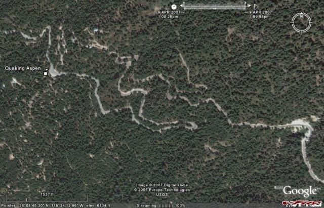
You are riding along enjoying this road, 190 in the Southern Sierras - export from Zumo track log to Mapsource to Google earth
Or you are storing pictures of the "bikes" at the Laguna GP race on your Zumo
Your Zumo is primed and ready to receive it looks like this.

And this happens - what do you do?

Wow! <_<
Is this a new thread?
-
Awesome information. So in conclusion, I will hardwire for MP3s and future XM, then I think I will just use Zumo BT and pull over if I need to contact the wife :D
But before you pull over and take off all your gear, you will be able to see that you have cell reception or if she called.

With the Zumo - you do not need to do this

Because you already know! Plus you can read the Zumo screen 100 times better than any stinking cell screen!
-
Really awesome write up. I just purchased my Zumo 550 and will get it installed tomorrow for my Saturday ride. Thanks for all the VERY DETAILED information. It made my GPS decision a snap.
One :goofy: question though, if you dont mind, forgive me if you already posted the answers...I might have missed it amidst all your posts.
1. I would love to take advantage of the hands-free cell phone abilities. What is your method of using the Zumo with your bluetooth phone? I have a Blackberry w/ bluetooth and have looked at several products to get hands-free reception in my helmet. What is yours?
Thanks!
I answered this for the Wing at the top of page 4. Now for that lovely 25th version.
If it was me :cool: ........and I did not have a headset and I was not getting a autocom/starcom type box, I would buy a Zumo rig (see pic below) plus a headset from Edsets. Their headsets have a fabulous rep with the Goldwing guys.

For me I could use this headset on my Wing or the VFR. :thumbsup:
The only problem with the Edsets would be that it might not work with the auto/starcom boxes as those guys use lots of proprietary connections. This would be a problem if downstream you wanted to add a RD or some other gizmo to your listening pleasure.
If you already have a headset/earbuds - what kind? Then you have to figure out if you want to jury rig a transmit capability or buy a new headset/mic combo.
Remember you do not need to buy anything to hear the phone if you have a headset already. Just turn on the BT on the phone and you are linked to the Zumo. Talking is the problem/opportunity.
-
Just a note about extra storage and SD cards. The Zumo can now handle HC SD cards. I have loaded my 4 gig SanDisk card with my kind of music. As a guideline, you can anticipate as much as 500 MP3 Songs per gig, dependent the quality of your MP3s. Quality and volume are good.
When I play this … :music:

I am so glad I don’t have to use this anymore. :cool: Note the khaki RAM mount and real time archive system for track logs. :goofy:

This is what I listen to while running the ridges in the Sierras. I hope to get to TN soon.

There is apparently a software driven 1,000 song limit for now. And make sure you put the MP3s on in a separate MP3 directory on the card as apparently the root directory can only handle so many songs.
You can save pictures and routes on the card. This is how you can pass routes to other Zumo users on tour too. Screen shots of the Zumo go into a separate directory on the Zumo itself.
Another database, I put on the SD card was the list of Honda dealers in the US. The dealer and other lists are available on the net in a variety of places. Maybe you want Starbucks dealers (I don’t) on your Zumo for example – you can have it.
You load these supplementary data sets (in this case a csv file) on the card using the Garmin POI (Places of Interest) loader, which you can download from Garmin. I used the beta version only because I am an early adopter – NOT. But I did anyway.
I don’t anticipate that I will use this because I have a VFR but……….
Let us say you are on tour and about to ride CA 36 from Eureka to Red Bluff which I hope to do in May. Before you launch off on one of the great roads of California, you feel like you need to check out the rumors of a RC-45 motor in the 7th generation VFR at the local dealer, apparently it is on the showroom floor – now!
7th Gen Prototype with Traction Control? Bags optional.

You know how to get there. Just follow the Red Wing that is on the Tank and the Zumo and Touch GO.
Places of Interest – Honda Dealers Eureka California

Route Lessons Learned next - sorry
-
Useful Things about the Zumo.
I have now played with the Zumo since the sleigh arrived in Dec and have pushed buttons during numerous short excursions on the MCs and truck. I planned two multi day trips where I built routes on the Zumo, and on the PC with Mapsource and Microsoft Streets and Trips.
The Zumo is very easy to operate. The touch screen and hard buttons are a snap to use even with gloves.
Here are some observations of what I like and use most so far:
First of all most new Zumo users will not appreciate how fast and how easily the Zumo homes on the satellites. You will take it for granted – well because it works very well and you have not experienced the delays associated with some of the older units. This is largely a function of the High-Sensitivity receiver or the SIRFstarIII chipset, which is considered to be the state of the art.
See - there is a reward for being late to the party or a procrastinator.
The redraw and recalculate times are even faster, which means you take the wrong road just to see what would happen the Zumo is instantly on the case unless you turn off or Stop navigating.
Whether you are in your garage, testing with your PC or in dense foliage or a canyon this thing never fails to get a fix and quickly. Even better when you are reviewing your route on battery at lunch or in some god forsaken establishment that evening, you will be able to calculate or change your route to fit your circumstances. While on the road I now know exactly where I am.
Knowing what is up ahead can be helpful in the twisties especially if you are riding a 900 lb motorcycle. But obviously watch the road too!

The feature I use the most is the distance to the next turn which is on the main screen. If you want a voice prompt beyond what the system gives automatically all you have to do is touch the lower right part of the screen and you get Jill or whatever babe you want to talk to you.

I like the fact that the prompt gives me the actual street name, ie text-to-speech, and distance as opposed to just take a left in X feet. This gets you looking for the sign precisely at the right time and actually improves your awareness I find.
Towards the middle of the day on tour, I start paying more attention to the ETA or Arrival time for the day. There are also two ways to get miles to go for the day either by getting to the MAP screen previously described.

Or by touching or sequencing the third hard button to the compass row screen.

This is of course all based on you loading one route for each planned day on the road. If your route or loop is longer than one day the ETA and miles to go features loose their bloom and value.
One significant bonus for the Zumo is that you can change your route on the fly and get an estimate of what it will take to get there ie miles/time.
Another especially useful feature on the road/tour is looking up the closest gas or hotels. Sure beats the heck out of cruising the town or even diverting into a town for a wasted search. Historically, I have planned with Streets and Trips and reviewed what town had dumps/gas in it. But on the fly, I just guessed. With Zumo I can instantly find what the choices are in Booneville USA. Now I see the choice on the screen, pick what I want and GO.

Rolling out of the twisties up to an intersection and not knowing which way is gas can be a problem. Go left or right I don’t know. No problem with the Zumo. I outlined the gas gage capabilities in an earlier post but that is prompted/alarmed by getting low as opposed to wanting to take a break and gas up at the same time.
Of course the Quality of dB is not perfect just like everything else. We pulled up to this place in Kernville on Zumo power – the price was right.
The main office. Friendly bunch with free continental breakfast.

Turns out the motel had moved down the street a touch. The places dB is of course out of date but tell me what set of records anywhere is not. Kind of funny though.
This one was in the dB.
My Outlook is controlled by me and guess what? It is not perfect either. As a former software company guy, I can appreciate the problem. Mostly right works most of the time on the Zumo.
Altitude feature when combined with the VFR/Wing temp gage gives you a sense when things could turn on you and what could be up ahead.

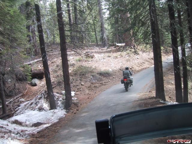
Ice on the road seems to be a fair indicator tooooo – Rt 168 by Lake Huntington.
I was not born with a cell phone as such as I indicated in previous posts I was skeptical of the whole Cell phone use on the Zumo at first. I am a believer now after using the feature on two outings.
And on last weeks Sierra tour, I called ahead and our dinner was ready when we crashed a buddies house for chow. Cool. Oh yea I can see the screen and cell functions on my Zumo about 100 times better than Razr cell.
More on Routing Next
-
I know this is the VFR forum, but like you I have both a 98 VFR and a 2002 GL1800. I am considering the Zumo and was wondering how you connected the GPS to the GL1800 integrated intercom and soundsystem. Does it come with the Zumo or do you need a accessory from Kennedy or similar?
Why would anybody want a VFR and a Wing?

Anyway the install on the Wing is pretty easy. Use the RAM mounts that come with the Zumo to put on your left grip. I did use the med length arm but I am back to the short arm that comes with the Zumo package.
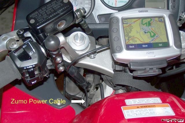
Next wire the Zumo power harness to the accessory terminals (which are switched) on the stock Wing fusebox and run the wire up (someway) to the left glove box area. Alternatively you can tap into the switched power connectors under the left glove box.
Go down to Walmart and buy a $5 dollar 3.5mm plug/wire extension and attach it to your Aux plug which is (you guessed it) under the left glove box.
Now you have a switched Nav/MP3/Cell receive capability.
If you want to talk on the cell through your existing intercom/headset call Jon at Goldwingadgets and buy the Kennedy GL1800 microphone integration components for about $115. That is what I did and would do again.
http://www.goldwinggadgets.com/GPS.htm#ZumoMic
Jon/Kennedy do have a cleaner power plug/auxext/phone input harness, which is cleaner looking than the above but am not sure how much it costs.
I can talk on my cell thru the Zumo, which incidentally has a lot better screen than any cell. You do not need anything to listen to the cell on Wing once you plug the aux in and turn on your BT on your phone. Phone and Zumo link automatically. I just leave the cell in the glove box plugged into the 12v charger.
You have to turn on the intercom to talk on the cell – works fine. You have to monkey with the mute and stuff but you can figure it out when/if you get it.
There are more expensive and comprehensive Kennedy integration kits but this does the basics well.
Jon at Goldwinggadgets is a jock on GL systems.
Here is a diagram of how far you can go. Sorry VFR guys but this is important - you may need this stuff someday yourself....... <_<

Enjoy!
-
Then there is “next generation†radar (NEXRAD) weather, which is not available yet on the Zumo. This is for the hard core tour and adventure guys.

Gee, I think I will pull under a tree or do the "Beverages on the Road" thread thing! <_<
-
Sorry, but I have been thinking whether I should have weather on Zumo???? Don’t ask me more.
The Zumo does everything at this point except weather radar which I have seen on the 478 series and is very neat.
I am fairly spoiled in California in terms of local climate change, but I can see this would be real handy on a long tour. Before I go on a trip I look at the long range forecast but it only goes so far and is only so good.
The weather XM capability requires the add-on GXM30 antenna.
The subscription for the NavTraffic (which includes weather) is about 10 bucks per month. These shots borrowed from another user for illustration purposes only :beer:


Really - lessons learned next
-
I have suspended my lessons learned bit till I get this out of my system.
I did not want to do this but my hand has been forced by my woeful attempts to KISS. You do not have to be a GPS aficionado (there are other harsher words I could choose) to operate the Zumo or for that matter Mapsource. If you are one of those simpler down to earth guys stop reading here. My wife describles me that way except she uses the adjective lazy too.
Warning - if you do read on do not consider this the Gospel just another neophyte passing gas.
Unfortunately, there are lots of confusing terms in regards optimizing Zumo routes ie waypoints, viapoints, favorites, shaping points etc and ad nauseum points. But as you get into it you most naturally want to fine tune what they can do with the machine on tour. I am starting to move in the latter direction as I become more comfortable with the Zumo/mapsource interface. This is not an esoteric discussion as some of the above does change how your Zumo performs and talks to you literally.
But you can manage without most of it so go back to paragraph two if you still kept reading and really did not want to. You can get there from here or to here.
To get a grasp of the nuances of route planning you just have to read the Manual eh WRONG!!!!!!!!!!!!!!!! Those stinking Manuals are just to get you going or to make you dangerous so go back to para two again if you must!
No, you have to spend some quality time, surfing and experimenting with the MS/Zumo. This awareness does not come by osmosis or by doing this the night before while on tour. :beer:
You have got to work at it and there is no bible that I know of. Just a bunch of stuff written by good natured fools like me based on their experiences. Everybody is well intentioned but it is like trying to reverse engineer something much better to have the afore mentioned secret sauce but we do not!
Unfortunately this is also a moving target as both the Zumo and Mapsource software are changing concurrently. In other words what works today my not tomorrow as things change.
For example version 3.0 of the Zumo software offered this - "Added ability to treat certain route vias as shaping points which will not be flagged or announced. Qualified shaping points are Intersections and points on roads which are not addresses, such as I-35N or HwyA. Requires routes to be created with MapSource 6.12.1 or using the zumo route planner."
Whatever that means. Regardless, this is what V4 Rosso was alluding to in his post.
Ok here is the short course (intact) again lifted from others so I can proclaim "plausible deniability" or don't blame me if you take responsibility like I do.
Layman's Description of Waypoint/viapoints and Shaping Points source - http://www.zumoforums.com/zumo/viewtopic.php?t=1132
"It depends upon if you want those points announced or if you are using them just to direct the route.
Here's the way I try to think about it. First of all, all the points in the route are viapoints.
Some are waypoints which are listed under the Waypoints tab and will be announced if they are inserted into the route. If you bring up the properties box, you can edit all the properties of the waypoint.
Some are shaping points which are special points that are placed at intersections to direct the route. The point properties box calls them a "map intersection" point and you can't edit the properties.
Some are neither. The point properties call them "map line" points instead "map intersection" points and you can't edit the properties.
For me Waypoints are places I want to stop along the route. Whether that's a restaurant, a scenic overlook, or whatever. I want the Zumo to tell me when I've gotten to those places. They are important to my trip. They will be flagged and announced on the route.
Route shaping points are points that simply exist on the route to "force" the route down that particular road. I don't need to have them announced because I'm not going to stop there. I don't even really care about the point itself. It exists solely to make the route go where I want it to. If properly placed, they won't be flagged or announced on the route.
The points that are neither will be flagged and announced on the route. Sometimes this in a pain if the points aren't important to the route which is why there are shaping points. Sometimes though, there's no intersection for you to place a point and you have to place one of these.
When you are making a route in MapSource, if you put the viapoints on intersections, they will help "shape" the route, but won't be flagged or announced when you are routing. They exist solely to force the route to go down that road, hence one of the members here dubbed them PONI (points of no interest."
OK I am back albeit briefly here is a further explanation of the new kid on the block shaping points. Source - http://zumoforums.com/zumo/viewtopic.php?t...t=shaping+point
"Waypoints are saved locations (they show up in the Mapsource Waypoints tab) that may or may not be used in a route. If they are added to the route, they will be flagged and announced on the route. Also, of course, the route will be "forced" to that location.
Viapoints are simply points along the route that are added by the user. They may be Waypoints, shaping points, or neither. If they are added in accordance with the method described for creating Shaping Points, they won't be flagged or announced. If they are added by selecting the route and dragging it to a location that doesn't qualify as a shaping point, they will be flagged and announced. Either way, the route is "forced" to go to/through the location.
Shaping Points are points on the route that are created at intersections and points on roads which are not addresses. You can add them to your route by them by creating points along your route which meet these criteria. They will not be flagged or announced. The route will be "forced" through the location.
There's no "button" to change a Waypoint into another "type" of point. You just need to create a new point (and then possibly delete the other point if you don't need/want it).
Yes, when Waypoints are part of a route, they are called Vias because your route is going "via" that location. Otherwise, they are like Favorites. They show up, but they don't help define the route
In the Zumo, a waypoint is called a favorite. Waypoints is the old name Garmin have used until they invented the "Favorite", in the new series of navigators, where the Zumo is one."
OK I am done clear now??????? <_<
Do you wish you had finished at para two? I warned you. :beer:
But with the Zumo and using the basics can get you to this easily
Next Simple Tips and Lessons Learned
-
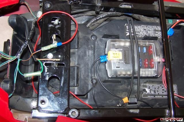
I followed the pack and added a fuse block and relay (I finally forgot and left an accessory on and killed the battery.) ...........................................
Now all I need is a beer tap on the back...
It gets worse when you get older. :unsure: Better now!
-
More On the Road with the Zumo and Mapsource
Just got back from a 1,300 mile trip to the Southern Sierras and a full Zumo test.
The GPS gets high marks and more than lived up to my expectations. I took my Wing on this trip as the Zumo is fully integrated into my sound system and I have the cell transmit function setup and I was anticipating some slab work to get there and back. But do I have to apologize?
Oh yes, I also have heated grips on the big bird and have not installed mine on the VFR yet.
But first you have to talk about trip planning. I planned the four day trip on Mapsource 6.12.3. This is critical to know as there have been several recent upgrades/fixes to MS to better support the Zumo. Make sure you upgrade both MS and the Zumo, which is up to version 3.20 now (4changes/updates since Santa came).
There are three enormous advantages in using Mapsource with the Zumo over Street and Trips and trust me the list does not start with the user friendliness of Mapsource.
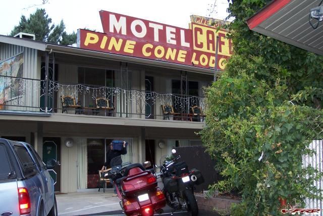
#1. Since the PC planning software map is the same when you find a place to stay in Kernville on your PC for example and then plug the route into the Zumo – the Pine Cone Lodge will be there as the map and POI/places databases are the same.
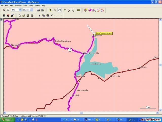
And Voila you follow the route and the Pine Cone is there.

#2 When you finish your trip and want to figure what you did versus what you planned you just have to load the trip logs into MS and you are ready to go to include loading the files into Google Earth with the touch of the mouse. This is the Borrego Campground, I showed a few thousand posts ago. You can also see the dotted track data on the Mapsource screen shot above as it heads north out of town as we tried to get over the pass the next morning – road closed though.
#3 When you craft a Mapsource route properly you do not build a lot of hard Waypoints like you have to do in Street and Trips to drive the route to a particularly twisty section whatever. You just use the route tool and change your route to accommodate your road preferences. The advantage of this is that you do not have a bunch of unnecessary flags/waypoints on your display which causes your Zumo to announce these places even though you do not care or want to hear about it.
You can see the waypoints/flags on this route constructed in Street and Trips or in MS if you use hard Waypoint – all of those flags interrupt your “Run the Ridges†MP3 file!

When you construct the route using MS and the route tool you eliminate all that.
This is a simple instruction set that I purloined off the Zumoforum website, which has replaced the old razorbike forum I posted previously.
http://www.zumoforums.com/zumo/viewtopic.php?p=2965#2965 There are more tips on the site.
1. In Mapsource, click on Route Tool. Click first (start) waypoint on map, scroll map to where your next waypoint should be, click again (2 waypoints will join), repeat this until you finish your route.
2. Is a waypoint in the wrong place? select 'Selection Tool' (arrow), click on waypoint to move, drag it to new position, click and revised Route is drawn.
3. Add additional waypoint into route? Right-click on yellow line of existing Route, select 'insert route selection', move (as 2.) to desired position.
4. Open Route Properties, untick 'Autoname', write your name fore this route in box.
5. Select Transfer / Send to Device, select Garmin, click Send
6. Unplug Zumo from USB, In Zumo click Yes to 'New Data Found', select Routes, click Import. Route is now in Zumo Route folder.
Here is another post that I had to read many times - “Mapsource Basics or MS for Dummies†– wonder why? Great stuff!
http://zumoforums.com/zumo/viewtopic.php?t...light=mapsource
Next - More MS and Zumo lessons learned
-
I am off to the Southern Sierras for a full road test of the Zumo and my Mapsource skills (?) When I get back I may be smart enough to write up a dumbman's guide/lessons learned to Mapsource and the Zumo. Maybe???
My last trip (May 06) to the High Sierras and numerous wrong turns were the genesis of my desire in the first place for a GPS/Zumo.
I reposted/expanded my original VFRD Sierra Trip Report below. Several new pictures are posted including some RC45s.
For you guys going to the GP, take a pass through the Sierras!
"Relatives and then the High Sierras on a VFR and a Wee in 06"
-
I had a question as to what wire I tapped to get the hot lead for the relay.
I have a 99 so here goes.
There are two wires coming from my licence plate light. One Brown and one Green. They are protected by a black wrap. This is confirmed from the wiring diagram courtesy of VFRD. All of the wires for all the lights go back into a common harness/rats nest also wrapped in black.
The hot one is the Brown. Green is ground. You can confirm the ground as all the other lights on the rear end use color wire in common - a Green ground. You can see that in the picture below.
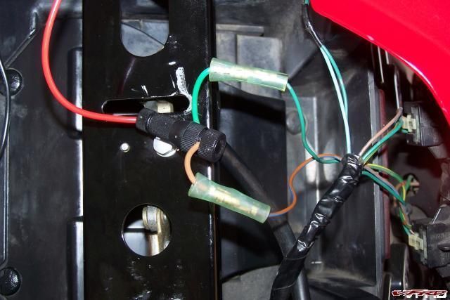
I spliced into the brown wire - the green wire goes behind the Tconnector (in the picture) back into the black wrap.
To test, before I spliced I used my red relay wire to hook into the plug where the brown L. plate light lead was. You can see the existing connector that I used - it has a male connector. The test worked the relay worked and the L. plate light did not. Obviously the brown bare lead goes to light and since it was unpluged the L. plate light did not work.
Make sense?
-
Hi,
I've been convinced. I'm supposed to receive my Zumo tomorrow. :salesman:
Where did you get your ram tank ball and all the accessories needed to install the zumo between the tank and the handlebars?
Thanks for the infos,
You will be happy.
Try the Ubolt Ram Mount and toss the Ubolt :wheel:
http://www.cyclegadgets.com/Products/product.asp?item=RAM-BA
These guys work as well as anyone.
You can see what the top part with the Ram Ball looks like here.
and here
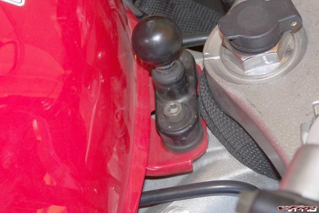
You will need to get slightly longer bolts but almost any specialty bolt place has them.
Tales Of Zumo
in Electronics
Posted
What happens when your actual track is better than the planned route and you want a better route for the future. You can convert the track to a route.
There are two ways to do this:
1. Convert segments of your active log into a route and save on the Zumo or the SD card.
2. Later when you download all the archive and active logs into mapsource, you can then upload relevant tracks back to the Zumo for conversion.
Here is a famous road bike route in CA - RT 36. :thumbsup: I downloaded all the tracks including RT36 from my 2,500/1400 on VFR mile CA trip to Mapsource. Copied the RT36 segment of the track to a clean Mapsource file. I could have changed the name of the May28 track too - but it was my birthday.
Then I saved the RT 36 GPX file on either the SD card or the Zumo in the Garmin/GPX directory. When you boot up the Zumo the new data will be recognized for import or you could wait and import later using the import data function.
The other tracks here were from a set of tracks off a generic 276 type Garmin I got off the web.
The Zumo auto converts the track to a route - Then you take a look at/check your new route - complete with voice prompts/directions/mileage etc.
California has great roads! Come on over, visit and don’t pay any state taxes!