BonusVFR
-
Posts
2,104 -
Joined
-
Last visited
-
Days Won
7
Content Type
Forums
Profiles
Gallery
Blogs
Downloads
Events
Everything posted by BonusVFR
-
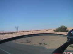
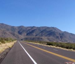
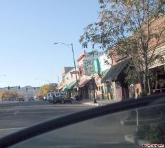
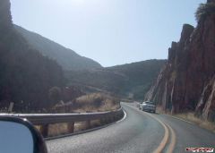
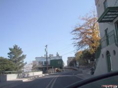
On the Road - Part Five Some of the biggest complaints about the Zumo from the GPS Nazis (that is what I call them) are that you can not see your actual track (not route - but where you have been) on the screen and there is no altitude reading. Both of these complaints were addressed by the latest software upgrade ie 3.X. Most of the criticism has come from people who do not own one. Kind of like VTEC, I guess. The number one complaint by far is “the Zumo†keeps trying to get you to your final destination†by recalculating the route when you stray far from the designated route. I will talk about this more with my wrap up. Anyway here is one of the upgrades, the altitude screen, which you can easily see by using the page hard button on left side of the Zumo. It is the third one. Or you can just hit the motorcycle icon on the main screen which gives you position and altitude. You can also save your current position as well if you want it for recall later. This is great if you want to mark a location you want to visit again. BTW Garmin now has a Red Motorcycle icon which I will upload in the future. Now to the track issue. After my overnight in Borrego, I returned the next day. Subsequently, I loaded ver 3.0 of the OS. One of the items touted with the update is “Added option to display track log on mapâ€. I was able to DISPLAY THE TRACK LOG ON MAP despite that I have been using ver 2.5 on the Borrego trip. You can now see the track log displayed while you are navigating. Here is the track of my breakfast stop North of Interstate 8 at a new Indian Gaming Casino. If you zoom in on the Zumo you can see the tiny road to the Casino as well. It is easy to activate the feature in the tools menu. This is how you "show" the trip log and make it visible on the map. You can now see the track log displayed while you are navigating. I guess this means that ‘breadcrumbs†are finally here and you can retrace a route if needed by following the track? This is the track from the entire trip. To the East you can see some of the track is not shown. I experienced Black Death on my Zumo (ver 2.5 loaded then) for about 30 miles till I figured out how to reset in Agua Caliente. Black Death is when the screen goes eh….black. This was the first and only time my Zumo has crapped out. I am certainly no expert but I attribute this loss of the track data due to the intense vibration I experienced while passing these Fill in the Blank just North of Octotillo. :lurk: This is where I reset the Zumo. Resetting is simple if you know how to do it but the instructions were in my trunk under some camping junk. The Agua Caliente Springs campground is on a poorly maintained loop south of the store where I stopped. I headed North once I left the store. By the way this is a good look at the level of the road detail available on the Zumo. Next Borrego or Bust :goofy:
-
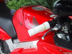
This one is just worth posting again. I'd follow their directions any day! :thumbsup: Now on a serious note, my Garmin C330 screen looks the same and it sounds like it functions the same. How are you getting the voice prompts into your helmet? I am hoping the new RED icon is better and does not have the extra weight of the second exhaust :thumbsup: OK - Here he is again??????????? The voice prompts and the MP3/etc come out of the MC mount female plug. Here is a picture of a standard type earbud plugged into the 3.5 jack. My IMC headset also works with this jack. On the Wing I just plug my Aux input male 3.5mm plug into the same place. Once you do it once you never forget! Right! :thumbsup: The covered jack above the 3.5 is for a 2.5mm plug typical of headsets for cell phones etc. The Zumo itself actually has no sound output. Only the MC and car mounts have sound output jacks.
-
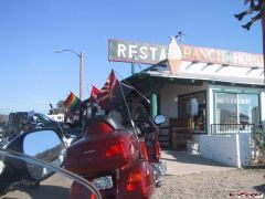
Part Four - Now about my field trip to Borrego with the Zumo. I met up with some buddies to escort me East from San Diego. As we never plan where our breakfast stop till the gas is in the tank, I did not have our feeding hole cranked into the Zumo. As soon as we veered off route the route to Borrego towards breakfast, Mr Zumo starting recalculating and trying to get me back on track. This may get tiresome especially when you following somebody else and not following backseat driving orders from the Zumo. Perhaps you have experienced this from your SO. Of course, I have not but I have heard about the phenomena. But fortunately, you can do something about the Zumo case, if not the latter. Regardless if you want the shut the lady off, just touch the MENU screen (bottom center of screen and then hit STOP. You stop following the route but you still know where you are. See … I am on a small side road close to the freeway here. Normally, the Zumo screen looks like this when a route or destination is loaded. This is the basic navigation screen and the key for me is the next "Turn In" on the bottom right corner of the Zumo. This tells you far to go before the next turn and provides automatic voice prompts as well. Please note that I was not speeding in these shots! If you miss the voice prompts along the way you just have to touch that “Turn In†on the screen and the Zumo gives you an updated voice prompt and the distance to turn. This prompt includes the name of the street you are looking for. This is fantastic and this is what I needed most on my recent VFR rides in the Sierras and AZ. :thumbsup: If you want to review all your turns just touch the bar on top of the screen in this case “Left on Lyons Valley Rd†Here are the usual suspects after Breakfast. Normally there is another 5th Gen VFR with us. That is as far as they went this trip. Instead of my VFR, I have been riding my Wing a lot this season. Not sure why - maybe because it was the coldest Jan in 40 years in San Diego and the electric grips on the Wing. I found my other 5th Gen buddy “riding at Lagunaâ€. Did I mention the racing was great? Notwithstanding yet another Indian Gaming casino stop in San Diego for breakfast and despite the “French Pancakesâ€, I was able to reload my route to Borrego. Takes about 15 seconds. When I restarted my route, the Zumo picked up my next waypoint/via point (still not sure what it is called) and prompted me correctly along my preferred route to the desert and on to Borrego. More on the road next
-
I forgot to mention that probably the best source on the web for Zumo info is: Zumo Only URL
-
Part Three Another shot of the Ram Mount with the medium ram bar. On the Wing, I have two RAM balls on the left grip, so I can add another accessory ie a camera in this case. I may do this on the VFR too. Of course you can always add another ball to the right grip but operating the equipment would be a pain - unless you have cruise. You can just see the Ram Mount Ball attached to the forward bolts on the tank. Many of you have done this modification on your VFRs and this turns out to be great place to mount the Zumo. Here is the Zumo on the tank ram ball again with a medium ram bar. The medium extender is needed again to clear the tank bag and also to allow access to the Powerlet socket in the stem. The screen of the Zumo shows one of the new views available with release 3.0/3.1. Compass and altitude along with GPS accuracy are there to see. None of the VFR instruments are blocked with this rig. To be frank there is not a lot of difference in left hand movement required from the grip to the handlebar mount or the tank mounted Zumo. You can see from these photos that it would be easy to access with the left hand. Most of the time I use the touch screen but I do use the hard buttons on the left. For sound I either plug the Zumo right into my Goldwing sound system via a 3.5 jack or just plug some ipod type earplugs/speakers or my IMC helmet speakers direct into the Zumo when I am on the VFR. You are good to go as long as your earbuds/speakers have a 3.5mm plug. Some folks do not realize that there are in effect two volume settings. One is the basically a balance between the relative vol of the navigation and MP3, this is controlled from the tool menu. The stock setting give a slight bias to the vol of the navigation prompts. The major volume control is the third hard button on the left. Next on the road with the Zumo
-
Part two First some miscellaneous ramblings and a brief description of route planning and the software that comes with the Zumo. The easiest way to load a route is to build it directly with the Zumo. It is pretty simple to figure out but it does take some time. Before you go too far though, I would register your unit and download the latest firmware for the Zumo. Otherwise you may have some problems interfacing with Mapsource (discussed below) down the line. Since Santa delivered, I have upgraded the Zumo software 3 times (2.5, 3.0 and 3.1). These updates included undocumented features (some people call them bugs) and suprisingly number of feature updates. :thumbsup: The other Garmin way is to build a route using Mapsource. This is confusing right from the beginning as City Navigator NT version 8 (in big print) is included with the Zumo package. Turns out Mapsource is the software interface/tool to (trip and waypoint management) organize/control the latest maps which are found in the City Navigator DVD. Fortunately, Mapsource is also included on the DVD disk but you have to read the small print to find it is there. As stated above, you do not need to load Mapsource onto your PC to use the Zumo. And for Pete sakes DO NOT throw away the yellow sheet with the Unlock code for Mapsource that comes in the box. Note DVD not CD that was my second problem. My old computer has a CD but not a DVD. Fortunately, I figured this out on my own before Garmin Tech support told me I was an idiot. But before you download waypoints/routes to the Zumo you need to update the Mapsource product too. Once you are ready to get your route to the Zumo, there is a menu button on the Mapsource tool bar to send routes/waypoints to the device (Zumo). Right in the middle of the tool bar below you can also see a similiar button so you can download logs so you review your trips on Mapsource when you get back. This is one of the views of what it looks like when you load the route into the Zumo. Note the flags on the screen which are waypoints, which in this case forced my route to 94 which runs parallel to Interstate 8. But there is no need to download maps to the Zumo, as City Navigator v8 is already loaded onto the Zumo. Do not load more maps onto the Zumo as you will fill up the drive. Perhaps you will load topo maps in the future but you do not need to do it right away. Mapsource is not a friendly as Streets and Trips but I do not want to whine tooooo much till I give it a chance. This brings me to the third way to load routes into the Zumo ie using third party software say, for example, Microsoft’s Street and Trips. This is not discussed in the Zumo manuals (latest one online the one shipped is already obsolete) but is described, you guessed it, on the Internet. This is how you do it. Build your route in Street and Trips using no more than 10 waypoints. Import your Street and Trips file into the this shareware program GPS Utility and save the file as a GPX extension. You can handle more the 10 waypoints but you have to pay for it. Copy the GPX file into the Garmin/GPX directory on either the Zumo or the SD card. Remember to “Safely Remove Hardware” first before disconnecting your USB Zumo. When the Zumo prompts you just import the route into the unit. One final route on building routes. Before you are done make sure it looks the same after it uploads into your Zumo. Some of the settings in the Zumo may change your route when you upload it. For example you may have fastest driving time set as your default in your Zumo and your route may be on a backroad, which may drive the uploaded route to change. The solution is to look at it after it is uploaded and if you need to add waypoints to force the route on certain roads. Pretty simple really once you have screwed it up a few times. I had to do the same thing all the time when I was planning routes on Streets and Trips even before I had a GPS. Sorry about the above but I had to learn all of this the hard way. <_<
-
It is raining in San Diego and I thought I would pass on some impressions on my new Zumo 550. Santa delivered my first GPS. The same woman who released me from driving her home from Arizona so I could tour AZ, bought me a Zumo without prompting and really no coaching. So I am going from this - To this – While I have used a few GPS units in rental cars over the years my last real experience with a GPS device was on a destroyer in the Indian and Pacific Oceans a few years ago. There were no cameras then so I do not have a picture. My God!!! Modern GPS units sure beat the hell out of a sextant, but for some occult reason I have not been an early adopter for my cars and motorcycles. I have been looking at GPS units suitable for bikes for years and I was particularly enthralled with the potential or hype about the Zumo. I even made the journey to Laguna Seca and the Garmin booth last year, along with about two million of my best friends, in part to see the first public unveiling at the GP. I must have seen these global units on the way to the Garmin booth. Latest display technology! :unsure: :goofy: Too bad I forgot my dual pane display instruments. The following key factors pushed me towards the Zumo: 1. I had two significant VFR rides last year (Sierras and AZ) and both times I could have used some navigational aid ie missed turns or had to reroute because of screw-ups. 2. My Verizon Cell GPS during my AZ experience was less than satisfactory. 3. The Zumo is waterproof, the right size and seemed perfect for both the VFR and the Big One. 4. The mounting kit adopted the RAM system, which I have on both bikes, plus it has a mount for my truck. 5. It uses voice directions and has a MP3 player which saves on precious cockpit space. 6. The Zumo is bundled with a trip planning package called Mapsource plus I could also use Streets and Trips, which I have been using for years to map out my adventures. 7. The Zumo has a battery which means I can evaluate routes and make adjustments etc while sitting in a restaurant. I find this very helpful as I often thrash out mid course corrections with my riding buddies during rest stops. With Zumo you can get an almost instant miles/time to go read out to properly consider your options. 8. And lastly it has the latest SIRF chip, which increases its sensitivity and responsiveness including those times when you are eating a greasy hamburger in a dump with a roof alongside the road in the sticks. Ten days ago, I rode from San Diego to Borrego Springs to test routing with the Zumo. As I was primarily interested in measuring the Zumo performance, I took the "other" bike as the Zumo was installed into the sound system and I had integrated my Bluetooth phone as well. Despite my initial difficulty, I used Mapsource to plan the route and down loaded the route into my Zumo. I had ver 2.5 of the Zumo OS loaded at the time. There have been two software upgrades since my trip. Wow they must really care! Next installment Trip observations.
-
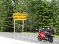
 Not sure but this photo makes me want a 6th gen more than any other except maybe the anniversary color scheme for 07
 -
-
-
-
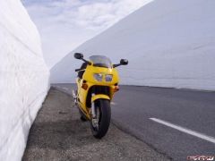
Banks of snow at the Aurland Mountain Road,
BonusVFR commented on tob's gallery image in Member's Gallery
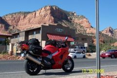
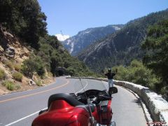
 Fantastic photo! Thanks. This is the top of Sonora Pass in the Sierras first week of June 06.
 -
-
-
-
-
-
-
-
-
-

-
-
-