

BonusVFR
-
Posts
2,104 -
Joined
-
Last visited
-
Days Won
7
Content Type
Forums
Profiles
Gallery
Blogs
Downloads
Events
Posts posted by BonusVFR
-
-
I have used Sierra Electronics IMC helmet speakers for many years. I use them with my integrated sound system on my Wing and with an Amp on my VFR for GPS and radar protection. Recently I used an upgraded set with my KLR riding the desert around Yuma. The new speakers were good enough I could hear my Zumo without an Amp and using earplugs. I have various cord adapters to plug into OEM sound system, an Amp or directly to the device.
I am a wired guy as I loath recharging batteries on long tours. I already have enough batteries.....with a Surface, phone, and two cameras.
You can see my 3.5 mm plug from the Helmet Speakers plugged into my Amp on the VFR here.

I carry ear speakers as a backup but frankly I do not like them. Helmet speakers are much more comfortable for me.
-
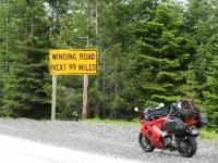
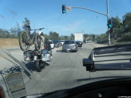
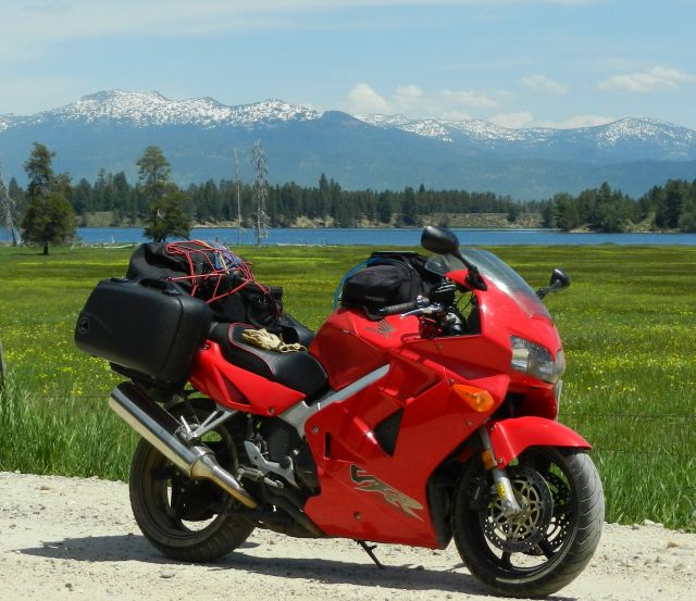
CC - Thought of you when I saw this in San Diego yesterday.
Apparently riding in Alaska is not great in January! Tires biased for long distance seems to be his choice. So at least an Africa Twin is an option for heading South.
Now that padding for camping (?) would not be my preference. I opted for a cot a few years back and it has been HUGE! I will post up if you are still looking for options here.
So based on what you have ridden so far:
1. Save money and take the ST1300 which would be great for most of the trip to get there and adequate in Alaska. Rent a KLR up there if you want to ride really tough stretches in dirt/gravel to Artic Circle etc. That way your Uncle could rest and see the sights for a few days. One of our problems in our 3 week trip is that we did not have time to explore a town/city for a day or so.
2. Spend the $$ and buy a GSA which would be perfect for the trip up and better than the ST for crappy roads under repair etc in Alaska. Have to love the big tank too. Ideal bike for loafing along with a Harley. That bike would be superb for most conditions but would be a handful if the weather turned to crap and you were fully loaded with street focused tires in the mud. I passed a bunch of the Big BMWs struggling on the "Top of the World" Highway in the pouring rain for example. The pristine GSA could have a few dings though when you get back.
When I go back to Alaska I will either do a repeat of my KLR voyage or buy a CRF1000.
-
CC are you taking an Africa Twin out in the snow this weekend?
-
Probably the best thing I ever did to my bike and for me! I was good for maybe two hundred miles before (And then pain) and that was when I was considerably younger. So when I really started doing longer tours the Sargent was the ticket and still is
-
Another big fan here. Use them on my trailer and truck.
When I bring two bikes I still use my Generation One variant but with my grip protector mod. It has been serving me well for over ten years without nary a grip issue.
-
That is a sexy "bottom"!
I was stunned about how much girth my hard bags added even with only relatively smaller bags. I think I put the actual numbers in a post on VFRD somewhere. I believe my Wing is actually narrower at the "Hips" than my VFR, but that is part of the design criteria for that GW. Just another one more factor to consider when upgrading to hard bags.
-
1 hour ago, jaydj said:
Loaded down Givi Wingrack w my bike rack w enough gear for a 4-day mountain biking trip in the Shenandoah Nat'l Forest. Skyline Drive, VA.
You are not the only one. I saw this rig a couple of years ago when I was coming back from a tour. Probably too much stuff for me if I was camping as well.
-
1 hour ago, Epyon007 said:
Well I have discovered that these quick release SW-Motech brackets are actually still available. I guess Twisted Throttle had some kind of computer SNAFU and can still get them, though they are in very limited quantities. I need to get my ass in gear ASAP and get some. Get the adaptors for them and you can put most any brand of luggage on there.
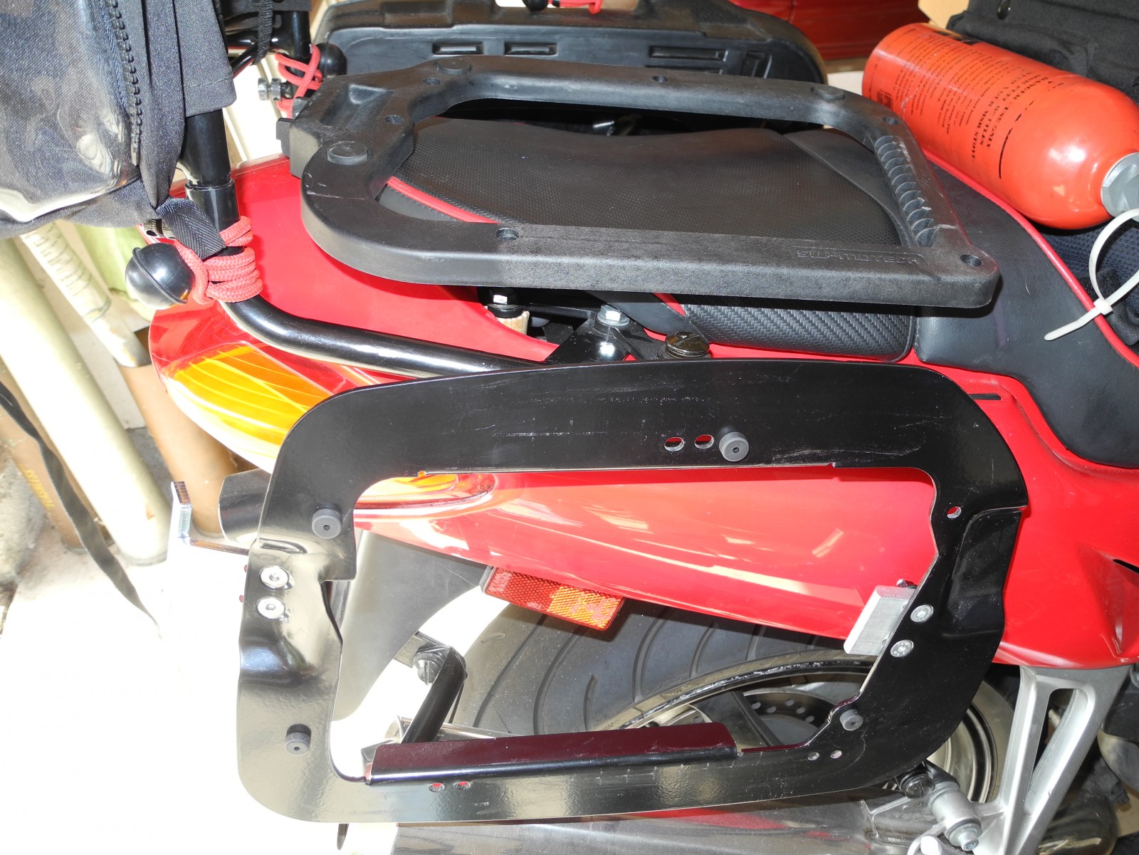
One thing to keep in mind about hard bags for the 5th gen is how fat your ass is! You know the bags! If you have been used to tucking that slim behind through tight spots you have to be more careful now... a lot more!. Unlike proper touring bikes with wider handlebars and mirrors our 5th gen "whiskers" are relatively narrow. This is what you use naturally to gauge how much room you have to fit in. I have nearly ripped my VFR bags off on occasion because I failed to take the bigger beam into account. Never had that problem with close fitting soft bags so did not think about that.
On that front I have the original SW quick release mountings. Here you can see a picture of the Hepco Becker EVO bag adapter on the seat next to the mounting plate/bracket. I found that I did not need the plate adapter which saved my about two inches of beam. So make sure you check which version of the SW mounts you are getting EVO or original?
Regardless, my recommendation for bag size is go small at first. This also forces packing discipline which is good!
My Hepco Becker bags are 30 liters but I could go to 40 if I really wanted to carry even more crap than I already do.
-
35 minutes ago, KevCarver said:
Oh man, you're not helping...


Most likely I would still want tubeless but ..............you never know? I guess the correct answer is ......IT Depends or the Perfect Bike for what?
OK I am ready for the review now.
-
44 minutes ago, KevCarver said:
I can tell you the review. It's great but has tubed tires...
I felt the same way until I started reading that some KTM 1190R folks are putting tubes in the fronts as a bent rim does not hold air (tube does though).
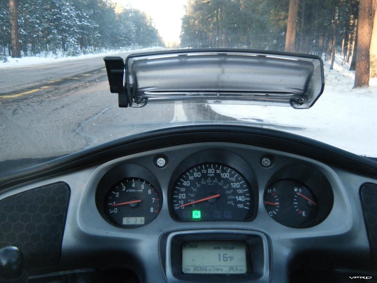
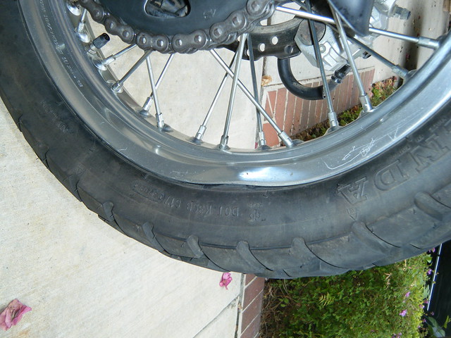
My KLR rear after I cleaned the dirt off courtesy of one MF huge Alaska pothole.
-
1 hour ago, SEBSPEED said:
I'm waiting for the AT review...
Me too! But I would buy it for future rides/tours as well.
-
On 12/23/2016 at 8:29 PM, CornerCarver said:
The VFR1200X has extremely intrusive traction control and has lost some 50hp in the migration from the 1200F. If I go with a Honda it will be the Africa Twin.
The Triumph Explorer XCA is the current front runner. Rode it today. Compared to the BMW GS or GS A the Triumph is not a better all around bike. I don't know when I will ever ride a better all around bike than the BMW GS. If you want the best tool for this job then buy the GS. Having the best tool for the job is great when we are talking about appliances or actual tools like drill press or shop vac or even a nice Vaughn hammer but I am passionate about motorcycles and the Triumph (while it seemed just "less" than a GS) seemed to be more passionate about the ride.Objectively the only place the Triumph Explorer XCA is better than a GS would be in front end feedback/feel or general agility/flickability if you will and a standard heated seat (front and rear). The BMW has a better feeling stock seat and would trounce the Explorer in any measured test off pavement but that sweet 1215cc Triple actually has some heart and wants to run and rev.
If you are playing a video game and the game has you riding from SC to Alaska and back the cheat code would give you a BMW GS A. That is how Tall Carver (Stephen) described the BMW. He said it would make the trip too easy. Instead of taking candy from a baby he said you would be punching a 5 year old in the face and taking not just his candy but everything else. Not cool.
Will ride a few more bikes on the list before making a decision but after the first quarter the leader is the Triumph Explorer XCA.
Did you ride the new 2017 improved model of the XCA with electric windshield?
I have ridden a few of the older variant and it does have some punch. In terms of Alcan travel it should have enough suspension travel. This is important as I even bent a KLR rear wheel on a pothole on the ALCAN. God only knows what would have happened to my VFR or Wing in that scenario. Wire wheels tend to be more rugged. I felt the Explorer was a bit top heavy and you probably will have to carry emergency gas.
There is lots to be said of the GSA for travel up north as it has a huge gas tank plus a large OEM pannier kit and many aftermarket bag options. Having a tanker along will give you some backup if your Harley relative opts not to carry emergency gas. Comfort will be very important on a trip like this so do not discount that. The GSA will be a good stablemate for the Harley whatever and you should be able to cruise at comparable highway speeds in the USA. As I remember road conditions limit speeds up North not the bike. The BMW was one of most popular bikes up in Alaska. My experience with the GS riders up there was very positive as one of them ran down our low rent KLRs to hand deliver some used/laundry "undergarments" which had fallen off the bike. They knew it was us since there were no brand names on the gear!
Like the GSA, Triumph has lots of amenities standard which is good as well. Indeed it looks like the Triumph is starting to creep up in price too when the options add up. The GSA costs a bunch but if money is not a major consideration the BMW still seems a good North to Alaska option. Not sure what the Triumph has these days for factory bag options but storage capacity would be another important consideration. I forgot are you planning to camp along the way? Not sure if the 2017 still has "floating" bags mounts or more rugged fixed case options?
What is your next bike test?
-
On 12/10/2016 at 7:08 PM, CornerCarver said:
This little video has me thinking big red...
Just watched this. That about sums it up. Captures the essence of the ride. Actually watching this could cost me a lot of money as I want to go back more than ever and on an Africa Twin. And gas is a problem but you can work around it.
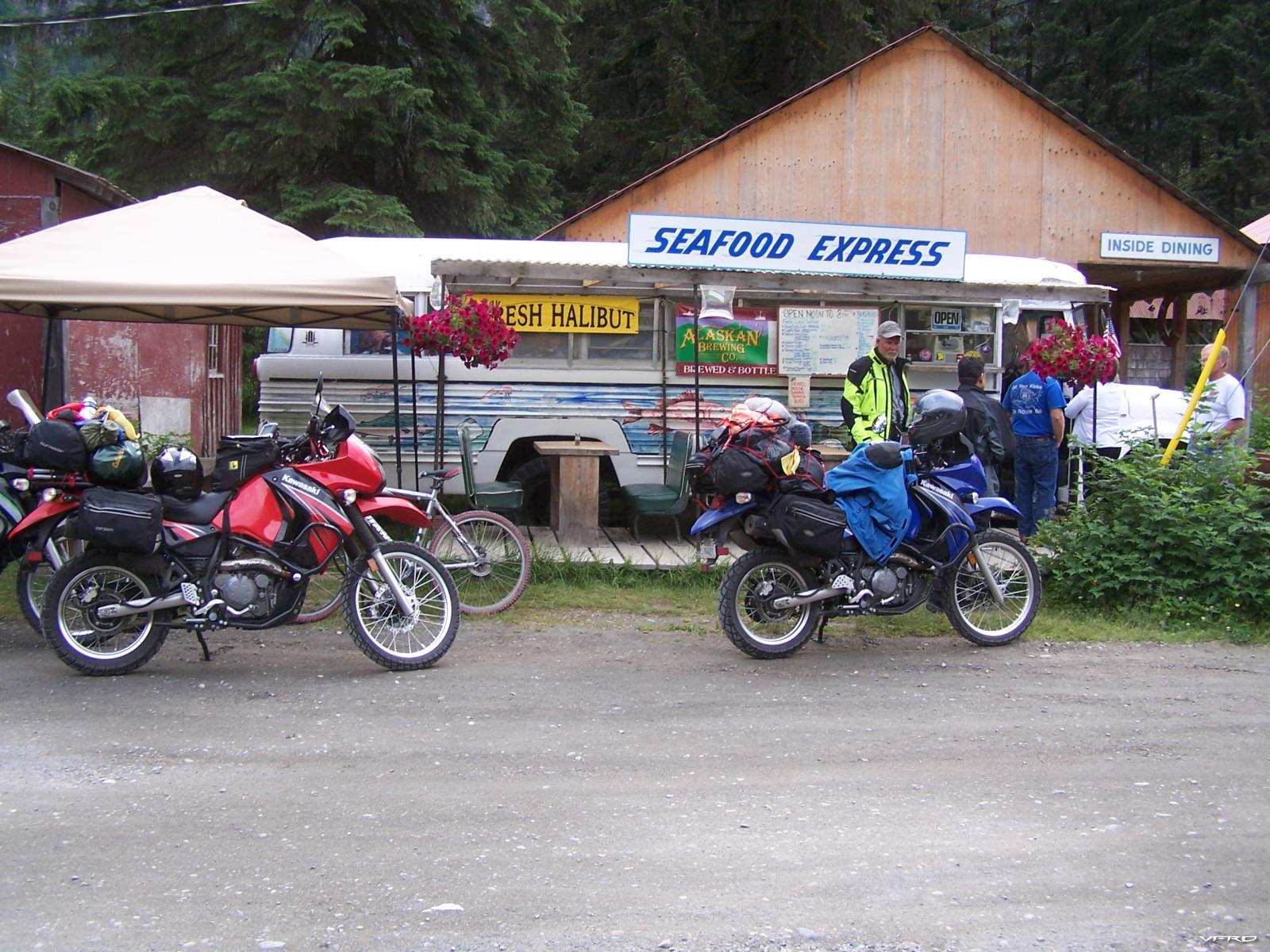
Fresh Halibut and Alaskan Beer in Hyder on the BUS. It rained that night!
-
12 hours ago, CornerCarver said:
Bonus I have read about 30 accounts of various transAlaskan rides and how they prepared (body, bike and gear) and what they would have done differently. You have been there and I greatly value your thoughts (I think I read a ride report from that trip of your several years ago) but eventually I just have to do it.
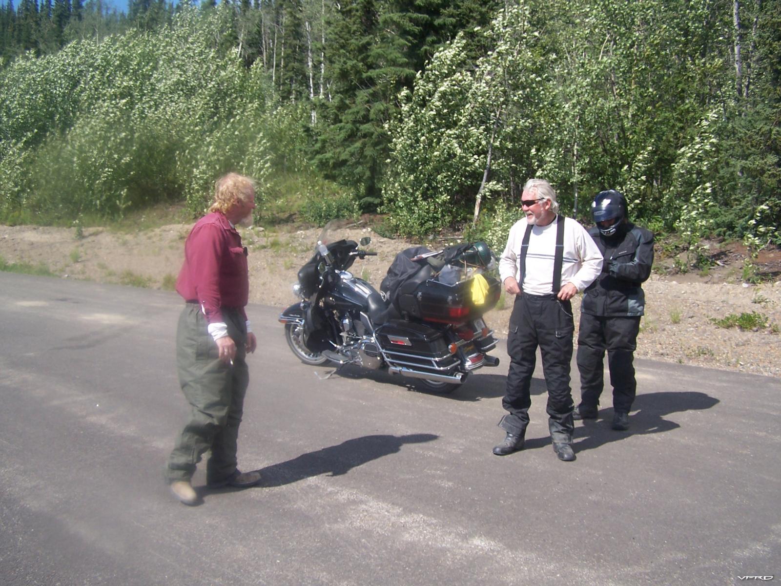
My uncle has been planning this for about 4-5 years. Several Hog riders have done it and he will too.
That being said, I would love love love an Africa Twin but it seems hardly necessary for an 11,000 mile trek when the AT will shine off the pavement and the HD will shine on it.I think I can do this on damn near anybike available today. So we will find out if I am capable or delusional.
Dunning-Kruger Effect is a distinct possibility.The most important part of one's plan is to go!!! We committed when we booked a ferry ride back on the Inland passage...best thing I ever did! You will never achieve plan perfection as there are too many variables and part of the fun is to just Wing it! Every kind of bike in the world travels up to Alaska! It is all good. Even if they don't go down bikes take a beating though!
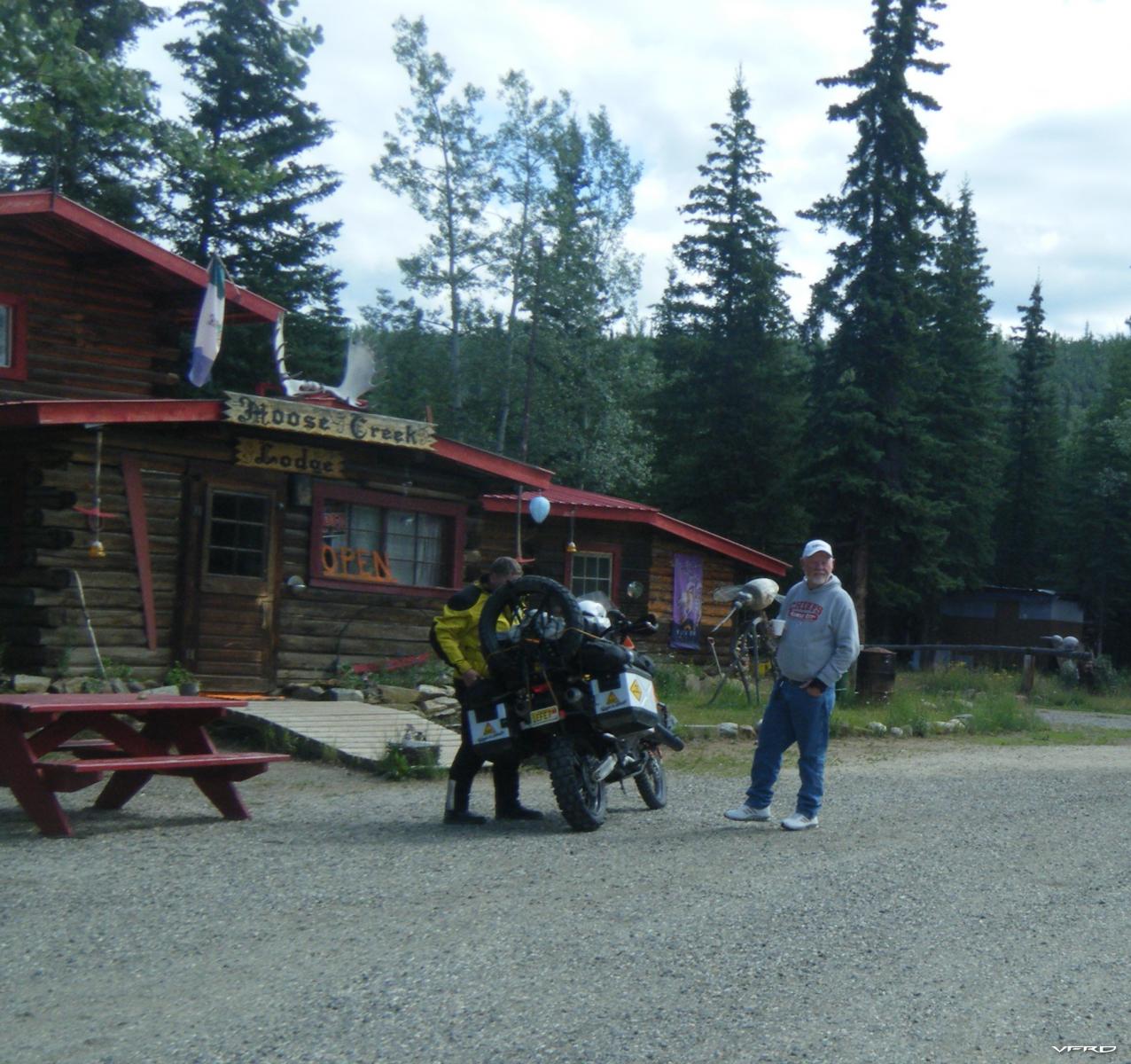
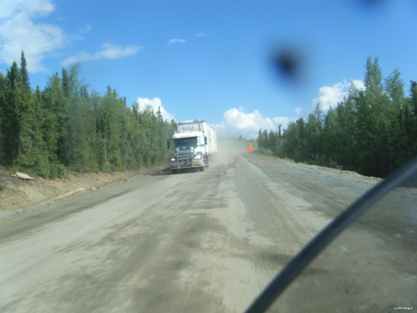
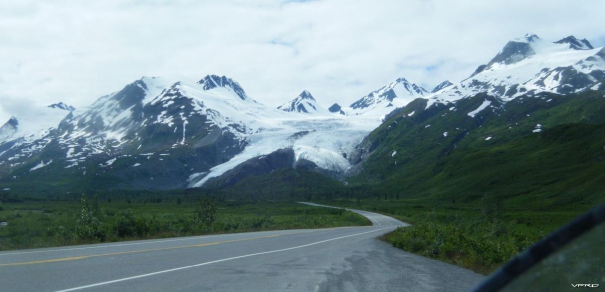
Think about tire management! This was a common sight. On the way up to Dawson City.
I remember this guy ..... he was "done" almost to Haines I think after coming from Florida. He was on a tour competition of sorts. Nobody with him and he was totally wired and exhausted....this shot was after a grueling gravel section of the main highway (maybe twenty miles again plus...but lots of these sections not just one). Lizard was his name and on a brand new "mostly then" Harley. The moral of the story is to stop when you need to....especially with the extra time you have available.
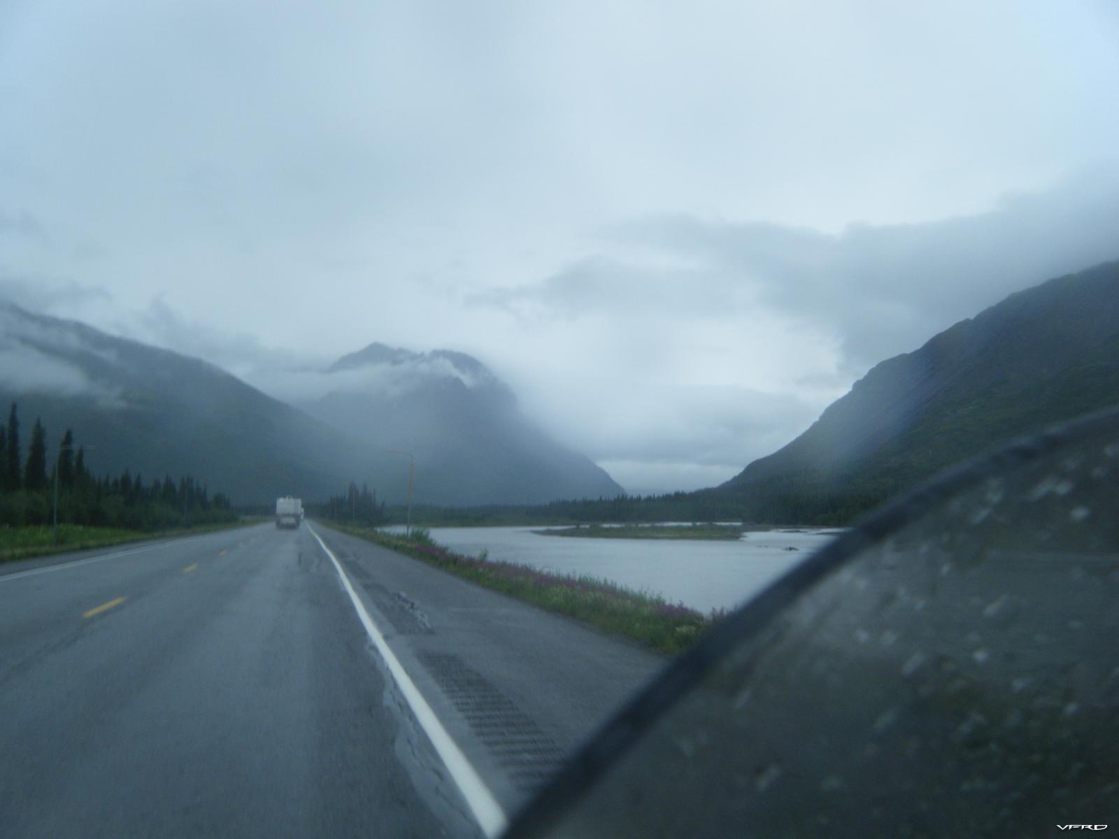
Also think about renting a POS KLR or Vstrom or something similar when you get to Fairbanks if you really want to ride the dirt. We started "the top of the world" in the sun and then it turned in to a quagmire. Wow that looks like sun but most of the time it looked like this.
Or this on the way to Denali. We camped in the rain that night again. We used heated vests and grips every day.
More Sun and shrapnel.
Do it! The trip is a right of passage and not about corners ...CC!
-
4 hours ago, gmtech94 said:
Or as in the case above just wing it !
Sometimes my Wing is the only way to go. More storage is just one factor it seems. The perfect bike is .......it depends.
-
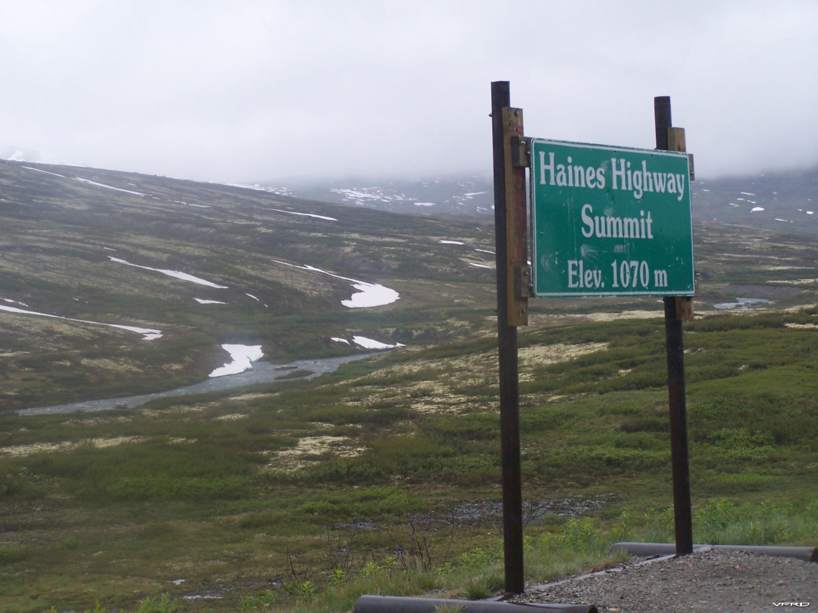
You have two problems: getting there and then what about Alaska and the roads way up north. When I went in Alaska in 2010 I only had 3 weeks but we still did 4,000 miles in Canada/Alaska on the bikes plus another 3,000 with a trailer from San Diego to Canadian Border, and 1,500 miles on a ferry in order to save time tires and asses. So many things to consider ....read some of the ride reports on advrider.
Any bike can do it BUT.........................................
We took KLRs which you could leave in a ditch forever if things went to hell. We left some bikes for Dead on the main Alcan highway when we hit 20 mile stretches of gravel and frost heaves. And then the bad roads and dirt in the rain. Rained every day except one for three weeks!
So when I go again I will take an African Twin or my trusty and disposable KLR. I would take an adventure bike for sure with fairly decent suspension travel and lots of gas.
-
2 hours ago, Epyon007 said:
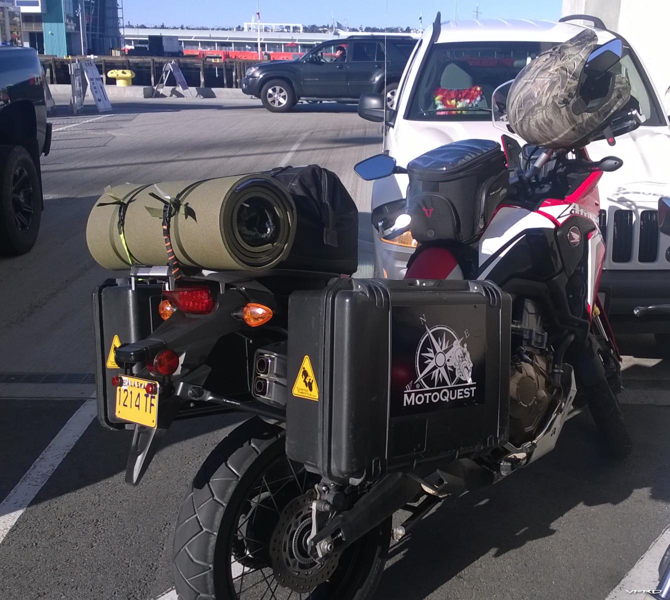
I've seen the Quick Lock stuff but no one in the states sells it that I can find. I sent Motech a message to see if they ship to the states. That would likely be the best choice. Now that bike looks pretty good. Having everything packed tight like that and not too high in the back looks good. I have Givi throw over soft luggage which actually doesn't look to bad. A tail bag with that would be alright.
I'm trying to get myself excited about touring on this thing. I took a trip from Minneapolis to Chicago on a Concours 1400 and I enjoyed myself. It was nice to have a nice big super tourer but I have seen so many people do lots of miles on VFR's that part of me doesn't think I really need anything more.
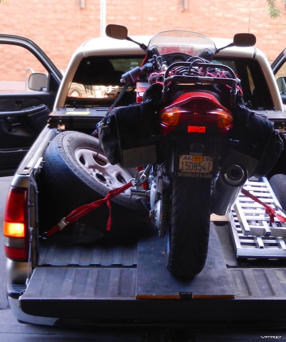
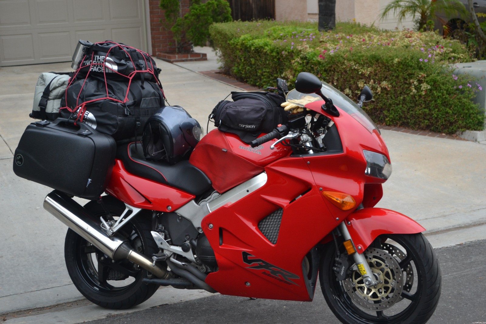
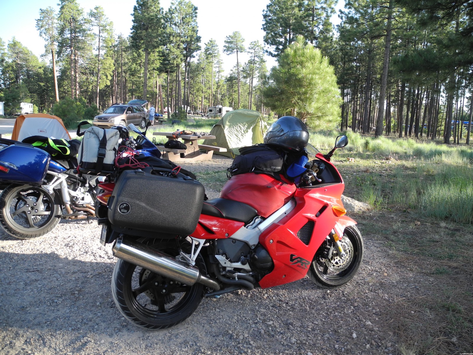
My VFRD touring thread about V4s to Utah has lost most of the pictures (many are in my gallery though) with VFRD software changes over the years so here is what my 99 looked like heading out.
Too much crap here plus I have now added a cot to my camping burden. Subtract the camping factor and you can get by with lots less stuff. That is a good way to start VFR touring ie no camping. I actually tried to find Timmy's bags when I finally pulled the trigger upgrading to hard bags but no such animal by then. The V35 bags would be ideal but how to mount...never found a solution for that on a 5th gen. One factor to consider is that junk expands to the room available so big bags means more well "junk".
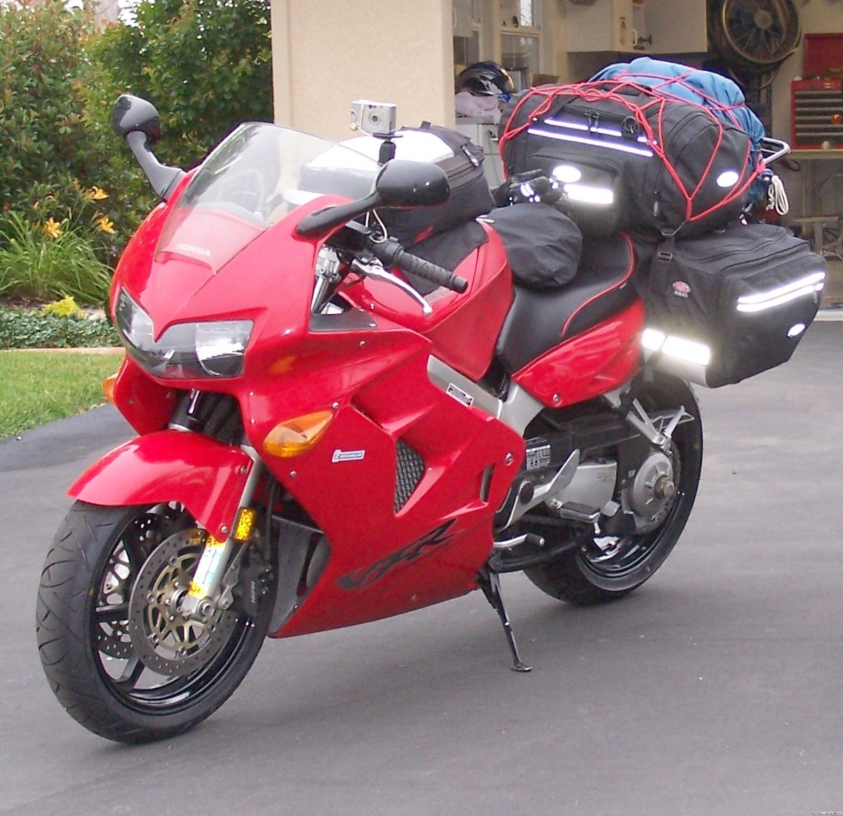
The really clean and lighter look about 10 years ago. This is with camping gear too but no chair, cooler and much much smaller pad & tent then and few amenities and electronics.
-
4 hours ago, Epyon007 said:
Am I the only one that thinks 5th gens generally look goofy with luggage on them? It's too bad that at least in the states it doesn't seem to be a very well supported bike by luggage manufactures anymore. I'd like something with semi quickly removable plumbing. Givi makes a quick release set for 6th gen I see. What do you guys have, got any pictures to share.
I agree the 5th gen aftermarket luggage situation is not the best for looks.
There are a couple of threads on 5th gen luggage out there. I may have started at least one.
Anyways here is my solution after going with soft bags for years. Hepco Becker bags with SW Motech quick disconnect racks.
-
Well should I get an African Twin or a Crosstourer? And then what bike to replace; VFR, KLR or Goldwing? Garage is getting full with 3 bikes, trailer and one actual cage.
-
I never have had a problem with the OEM VFR riding setup as it mimics my bicycle position. Bicycling has been my sport of choice for staying in shape. I really believe that being in modest condition has allowed me to ride longer and in hotter weather. Nevertheless being in shape is no panacea for brutal heat as it just postpones the inevitable but it gives you more margin for error.
I just canceled a Colorado tour as my endurance sucks due to a couple of weeks of inactivity and hospital shenanigans.
Ride safe and stay hydrated!
-
As California burns again there is one other thing you can do. Get in shape! This could be as important as anything else....although the toy hauler above looks to hit the spot too.
-
On 7/24/2016 at 9:09 AM, FJ12Ryder said:
I started motorcycle touring in 1973 on a '71 Triumph. Not knowing any better I toured in the summer, which means you cross hundreds of hot. flat miles before you can get anywhere interesting: west is Kansas/eastern Colorado, east is Missouri, Illinois, Indiana, south is, well, hot, north is Iowa and Minnesota. In later years I started going in late spring, and early autumn and avoiding the worst of the heat. The last 10 years or so we've been traveling with a 5th wheel toyhauler and taking the bikes. It's very nice in a way since we now travel to where we're going to ride, and then spend several days in the area riding, unencumbered by having to haul touring supplies on the bikes.
The only thing I would never do is trailer/haul my bike to a motorcycle rally. I think that's one of the reasons I've always avoided Sturgis and other rallies of that type. What part of "motorcycle rally" don't they understand?
The 5th wheel rig seems like a sensational idea to me. What bikes do you take? I really have taken a fancy to the base camp plan. Frankly sleeping in a tent is starting to lose its charm for me plus as you stated you would not have to pack all that crap on the bike.
-
10 hours ago, JZH said:
All I can say is that a lot a Germans seem to do this in Europe: trailiering down to Italy, where they (presumably) then ride around. Or maybe they're off to Tunisia? No idea.
I'm hoping to load my family and Aprilia RS250 into my van for a trip down to the San Sebastien area in Spain later this summer. Just so that I can have a day or two on my own with the bike during the week or so that we'll be there. We'd probably be taking the van anyway, so we can load up with decent wine and Continental delis on the way back!
But it still seems like cheating!

Ciao,
How about leveraging your valuable time and taking care of family tooooo instead of cheating.
As I indicated earlier I used to do more truck/trailer gigs and frankly I am heading that way again....for good reason!!!!!
I read this guy's reports etc on Advrider every so often. He has done some pretty hard core rides but he loves his van as it saves time and wear on his bike, tires and body!
http://bigdogadventures.com/Transit.htm
-
23 hours ago, hotshoerob said:
I found this link on a local forum...kinda cool idea, I like the money shot at the end
Aerostich used to have a air pressurized rig something like this. Hit the button max and you get a blast of cold water. Not sure if they still carry it. Maybe better to drink it but the Tour de France guys always seem to be pouring water on their heads??
Once after a long hot tour I looked for other cooling systems like the AC in my truck. I was desperate then. These solutions are really not for the casual rider perhaps only for the Iron Butt crowd and then only if you have a really BIG bike. Not sure these ideas would get VFRD approved.
A chilled water solution:
http://www.veskimo.com/body-cooling-vest-products.php
I used something akin to this years ago after I was taken out on a bicycle ride by a head on attack by a Big German Sheppard. In that case constant cold water to the shoulder after the surgery repair speeded the process.

They also have a smaller backpack unit.
And traditional AC ie cool air!
http://www.bikeairusa.com/support.html
I never went there as you would have to carry it all the time. Plus I already have too much crap!
Something like these may be apropos if you are doing a trans USA tour in August crossing the southern USA and back! But why would you do that?

Truck guys
in OTHER Motorcycle Talk (non vfr)
Posted
Well I go both ways...hah! Here I have returned to soft bags for a quick trip and meetup with the SO and bonding for the trip home. Most times I just use the truck for the VFR. But I have used the trailer a few times with the middle bike. There is no perfect solution so I have both.
Here I am being rescued by the same SO after a Kidney Stone attack while in camp on a "hot" VFR tour.
Usually I combine the VFR truck ride with some sort of other event.
Sometimes a trailer does hit the spot. My 2nd generation Kendon which is over 12 years old. It does seem to make sense in this scenario?
If you get a trailer make sure you have at least two rails as it is inevitable that a buddy wants to tag along. In this case I was bringing another bike for my bro. I really like the option of the truck or the trailer. As I wrote in a thread "But It is a Dry Heat" last year getting across the desert and setting up a base camp often works out best for me and optimizes the riding experience. Sure beats a survival experience.