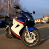
Member Contributer CasualSwede Posted January 5, 2014 Author Member Contributer Share Posted January 5, 2014 Day 4: Provo to Delta, August 13th. ~600 km. After three days on the road, I expected to start feeling worn out. But feeling worn out would have to wait… I’m on vacation! Today, this day, we conquer Moab! And by conquer, I mean see as much as we can see within a few hours. Time to hit the road, after doing the morning ritual of the ABC’s (checking Air, Brakes, and Chain) and topping up our fuel tanks. We struck out east on U.S. Route 6, the second-longest highway in America. (I only found this out because Google labeled it as the “Grand Army of the Republic” highway). Initially, the landscape was quite similar to what we saw the previous day. After about an hour of riding, though, it had definitely changed from the gentle tree-covered slopes to more harsh and upright rock bluffs. The descent through Price Canyon Rec. Area and on towards the town of Price was the final step in the terra firma transformation. The highway traversed fewer elevation changes, and the harsh bluffs became a distant backdrop rather than an imminent photo op. The seemingly ever-distant rocks started to close in… only this time, they were red. I smiled to myself, because if this seemed cool, Moab would for sure blow it out of the water. I pulled alongside Jesse and snapped a few pics as we slowed for the long line of traffic. Construction, it seemed, was something that was necessary to support the herds and herds of people on their way to see a bunch of weird-shaped rocks. We (deliberately) rode past the entrance to Arches National Park in order to fuel up in Moab, crossing the cloudy Colorado River just on the north end of town. By this time, it was noon, and the full-leather protection was starting to stick. A supremely quick fuel stop, and we headed towards the park entrance. Once we arrived at the Park’s information centre, we found the water fountains and drank as much as we comfortably could. I then proceeded to drink a bit more for good measure. I knew I’d be losing a lot in the next few hours, judging by the intensity of the sun and the resultant +40,000 degree heat. I may be exaggerating a bit, but still. It was very warm. We decided that since the park had a speed limit of 30mph or so, we’d squid it up and ride without leathers for a while. I piled mine precariously high under the increasingly strained cargo net. Perhaps today would be the day my pasty white chicken legs would catch a tan! (Spoiler alert: they didn’t tan.) Fully geared down as skin crayons, we hit the park road at a brisk 30mph. The first stop along the way was Balanced Rock, a large rock that somehow climbed onto another and used its innate sense of balance to stay standing. Truly amazing stuff. The next notable sight along the way was the bold outline of Courthouse Towers. Standing tall and imposing, the road takes a slight detour at its base. After riding for half an hour, we got to our destination of Delicate Arch. Well, not exactly. To get to the arch itself requires a bit of a hike, more than we had time for. The shortcut method was to do the shorter hike (only a couple hundred yards), but it wouldn’t get us as close to the arch. Win some, lose some. Leaving our bikes (and gear, and personal belongings, and…) in the parking lot, we began climbing. The rocks along the trail were cracked and bleached, almost as if they were the severely dehydrated skin of the land. Yet somehow, plants were still growing. The trail ended, and we were atop a crest. A crest quite far from Delicate Arch, it seemed. I’ll be honest, I was disappointed at how far this trail hadn’t taken us. But with no other choice, I just zoomed in all the way and snapped away. This photo is a crop of the original zoom, and those specks along the skyline are people who did the long hike. So it looks like I’ll need to return to Moab to do some hiking… We had already burned a couple hours in the park, so we had to resist the urge to stop for every little rock that looked cool. And there were quite a few that were interesting. I’ll let the pics do the talking. I’ll be coming back to Moab for sure. We took our leave of Moab by riding northeast on Hwy 128, which also offered beautiful scenery. Unfortunately, this was balanced out by some of the worst tar snakes I’ve ever ridden on, making it difficult to ride quickly. All the more time to see the sights, I suppose… We finished the day by riding the Grand Mesa Scenic Byway, passing through Mesa and ending in Delta, Colorado. Unfortunately for you guys, the road was too fun for me to be taking pictures while riding. The land had transformed back into smoother foothills, and this gave the byway plenty of changes in elevation and extremely fun curves. Arriving in Delta, another nondescript motel was the name of the game, and after taking care of ourselves and our bikes, we found an oddball restaurant. The oddest part of all was our waitress, who decided she wanted to speak with an extremely out-of-place accent (British girl living in Texas, maybe). Not sure if she was practicing for a role in a play, or if she was having fun with a couple of weary travelers. Another day in the wind, thanks for following along. Link to comment Share on other sites More sharing options...
Member Contributer vfrAustin Posted January 5, 2014 Member Contributer Share Posted January 5, 2014 I appreciate you taking the time to post your journeys. I hope you found the time to go to a pueblo on a reservation. It is hard to get a real experience usually without knowing someone there. A Pow Wow is a start. I knew people at the Taos pueblo and learned a lot about the good and the bad of what they went through and are going through. If not, on your next trip. Again, thanks for posting. I am hitting the cabin fever max right now and need the mental motorcycle stimuli. Link to comment Share on other sites More sharing options...
Member Contributer CasualSwede Posted January 6, 2014 Author Member Contributer Share Posted January 6, 2014 I appreciate you taking the time to post your journeys. I hope you found the time to go to a pueblo on a reservation. It is hard to get a real experience usually without knowing someone there. A Pow Wow is a start. I knew people at the Taos pueblo and learned a lot about the good and the bad of what they went through and are going through. If not, on your next trip. Again, thanks for posting. I am hitting the cabin fever max right now and need the mental motorcycle stimuli. Thanks for the feedback, I'm glad you're enjoying my report! Half the reason I'm writing it is due to the winter weather (with no end in sight, apparently). The other half of the reason, of course, is to give back to VFRD.... Unfortunately, we didn't have much time booked for excursions off our bikes; I do quite enjoy learning about lifestyles and histories that are different from my own experiences. But, like you said, I'll just have to do it on my next trip... (of course there will be another) Cheers! Link to comment Share on other sites More sharing options...
Guest Recalcitrance Posted January 10, 2014 Share Posted January 10, 2014 Very cool photos and great write up. Gives me another place to shoot for. Hope to read another report after the weather warms up. Thanks for sharing! Link to comment Share on other sites More sharing options...
Member Contributer wrestler Posted January 10, 2014 Member Contributer Share Posted January 10, 2014 Thanks for the report, Spencer. This has really been a great read. Make me want to jump on my bike and ride west. It is a shame work gets in the way of riding. Link to comment Share on other sites More sharing options...
Member Contributer Switchblade Posted January 11, 2014 Member Contributer Share Posted January 11, 2014 +1 on the cabin fever thing I hate this time of year but at least I have time to upgrade the VFR ... Link to comment Share on other sites More sharing options...
Member Contributer 007 Posted January 15, 2014 Member Contributer Share Posted January 15, 2014 The GSXR killed a battery before the VFR: now if that doesn't beat all. Thanks for writing away the winter blues for me! Link to comment Share on other sites More sharing options...
Member Contributer mk2davis Posted January 17, 2014 Member Contributer Share Posted January 17, 2014 Is it over? Please say it isn't over . . . Link to comment Share on other sites More sharing options...
Member Contributer Switchblade Posted January 17, 2014 Member Contributer Share Posted January 17, 2014 Maybe Monday here high of 54 degrees .. Link to comment Share on other sites More sharing options...
Member Contributer CasualSwede Posted January 17, 2014 Author Member Contributer Share Posted January 17, 2014 Is it over? Please say it isn't over . . . Haha just past halfway through. I've just been prioritizing work and skiing over writing... Link to comment Share on other sites More sharing options...
Member Contributer mk2davis Posted January 17, 2014 Member Contributer Share Posted January 17, 2014 Oh, sure. Be responsible and enjoy the weather. Link to comment Share on other sites More sharing options...
Member Contributer CasualSwede Posted January 25, 2014 Author Member Contributer Share Posted January 25, 2014 Day 5: Delta to Colorado Springs via Pikes Peak, August 14th. ~500km. With any luck, by the end of the day I could cross off an item from my bucket list; riding up Pikes Peak. Pretty exciting! We struck out east on Hwy 92, which then turned into 133 as it took a more northeastern heading. Colorado was quickly working its way to the top of my list of favourite American states. Finishing the previous day on the Grand Mesa Scenic Byway was what started it all, I think. Today’s ride along 92 didn’t feature quite so many undulations on the map as it did on the actual road surface. But a few bumps aside, the scenery was still very easy on the eyes. The dense evergreens covering the surrounding slopes eventually gave way to sparse grassy ranges as the land opened up and flattened out a bit. “Flattening out” is a relative term, anyways, because if I see any elevation change in the terrain, it’s not as flat as home. But I digress. We refueled in the town of Carbondale and then turned southeast on 82 towards Aspen. I began to see the influence of ski money; the road was twinned for the high volume of ski traffic, and some of the houses and condos were beyond pure excess. A quick look on the internet confirmed this; median price for a home or condo is $4.57 million. WOW. Too rich for my tastes! We wound our way slowly through Aspen, and I was surprised to find that the route through town was old-school in that there didn’t seem to be a major bypass. It’s nice to slow down once in a while to get a feel for a place, even if one is just passing through. Just east of Aspen, another pleasant surprise awaited us: Independence Pass; it may only be a handful of switchbacks and sweepers, but what a handful! The scenery was stunning, everything I had ever imagined Colorado should look like. After the last hairpin, the road settled down into gentle curves more suitable for taking in the alpine scenery. We caught up with a group of sport-tourers as they turned around; among the group were two blue 2012 Veefalo’s, making for an unprecedented three VFR’s in one spot on our trip! Unfortunately, their immediate about-face meant there would be no chatting them up about their travel plans. A few minutes later, the road was choked down to alternating one-way traffic due to construction. We were waved to the front of the line by a motorcycle-friendly SUV driver; just another reason to like this place. Eventually we intercepted Hwy 24 and took a southeast bearing towards Buena Vista. We stopped for lunch at The Rooster’s Crow café. Another one of Spencer’s highly recommended food stops! We had great service from our waitress, who saw our water packs and brought a pitcher of water to the table as soon as we sat down, allowing us to refill them expediently. It’s the small stuff like that that makes me smile when I think back on it; the human race isn’t so bad after all. After working our way through some excellent club sandwiches, the elderly couples at the next table over began chatting to us, with the normal questions and responses we had come to expect: “That’s quite the gear, where are you boys headed?” - older gentleman “Well, we hiked a bit at Moab yesterday, and we’re hoping to ride to the top of Pikes Peak today.” – me, just now realizing how lucky I am to be able to say things like this. They marveled at how far we had come in four days, and one of the gents told us a story of a friend that rode to the top many decades ago, and was planning to return to ride to the summit again on the exact same bike. I can’t remember the bike in particular, but for some reason a Norton or Triumph comes to mind. Pretty cool stuff, I hope to be telling awesome stories when I’m his age. Spirits uplifted and stomachs filled, we continued east and caught our first glimpse of Pikes Peak. It must’ve been at least fifty miles away, but just the way it shouldered above its neighbours, I could tell it was the one. We sped up. Behind us, a truck sped up, too. He passed us. A few miles later, we passed him. Pulled over by The Law. We slowed down. And laughed in our helmets. It was mid-afternoon when we refueled in Woodland Park, a handful of miles west of the starting point of the Pikes Peak Toll Highway. We paid our toll and got the spiel from the woman operating the toll booth; recent rains had washed some gravel and silt onto the road, and we were told to expect it at any point. We thanked her and ventured forth. This road is a playground for motorcycles. It is far and away THE MOST fun I’ve had on public roads. Words aren’t enough to describe it. Pictures are better. Videos are better yet. But there will never be a replacement for actually experiencing it firsthand. Naturally, I didn’t stop for pics on the way up, so GoPro screenshots will have to suffice, at least until I can put a video together. The woman at the toll booth wasn’t wrong; the lower section of the mountain had a few corners with a scattering of gravel, mostly avoided by riding in the tire tracks. As we climbed and climbed, the corners cleared out, as did the traffic. I honestly expected a lot more, but we only passed maybe a dozen cars on the way up. Partway up the mountain, there was a brake check station for vehicles headed downhill; a man with an infrared thermometer was gunning every car coming down. This could only be a sign of good things to come, I thought. And so we continued. The trees thinned. The air thinned. My bike’s carbs began to feel it, pulling less aggressively out of each corner. Peering over the almost nonexistent shoulder, I kept up as much speed as I could; gaining it back was a slow process. Switchback after relentless switchback, we finally emerged at the top! The combination of the exhilarating ride and the altitude of 14,110 feet meant we were both out of breath. Even just walking around was a chore! We checked out the trolley car that rides up the non-highway side of the mountain, bought the requisite postcards, coffee mugs, and shot glasses, and turned around to head back down. We stopped a few times to take pictures of the road we had travelled so far to ride. As I was taking this picture, it began to snow! There’s a melted snowflake on the lens near the centre of the photo. Time to get off the mountain before it’s unrideable! We rode cautiously, the pavement seeming much cooler than an hour previous. Eventually, we made it off the mountain without incident. The most exciting road I’ve ever ridden was now in the books. A short ride into Colorado Springs, and we found ourselves at the Rodeway Inn, yet another motel with no concept of modern internet connections. Oh well, this is what we get for cheaping out, right? We celebrated the day’s ride by walking to a conveniently close German restaurant, Edelweiss. A couple of German pints and a few motel beers later, I was in a good enough mood to climb onto our motel’s roof and snap a picture. Without question, riding to the top of Pikes Peak was the highlight of the trip. The combination of curves and (literally) breathtaking views just can’t be topped. And as I said before, it’s impossible to convey the adrenaline rush of experiencing it firsthand. It’s better in the wind. Link to comment Share on other sites More sharing options...
Member Contributer Switchblade Posted January 25, 2014 Member Contributer Share Posted January 25, 2014 Gotta update the bucket list now .. THANKS GUYS !!!! Link to comment Share on other sites More sharing options...
Member Contributer CasualSwede Posted January 28, 2014 Author Member Contributer Share Posted January 28, 2014 Gotta update the bucket list now .. THANKS GUYS !!!! bucket lists are SUCH a hassle! Link to comment Share on other sites More sharing options...
Member Contributer Switchblade Posted January 28, 2014 Member Contributer Share Posted January 28, 2014 Link to comment Share on other sites More sharing options...
Member Contributer JETS Posted January 30, 2014 Member Contributer Share Posted January 30, 2014 Yep, these bucket lists are killin' me. Link to comment Share on other sites More sharing options...
Member Contributer CasualSwede Posted March 3, 2014 Author Member Contributer Share Posted March 3, 2014 Day 6: Colorado Springs to Steamboat Springs, August 15th. ~450km. Note to self; write ride report sooner, the details are fading! Good thing for pics and videos to refresh my memory. With any luck, I’ll get this done before riding season starts… With about 2000 miles on the clock, the turning point in the trip had come. We were at our most southeasterly point in Colorado Springs, and it was time to head back to home sweet home. There was one major obstacle, however; Jesse’s rear tire (an old Pilot Power) had rapidly run through its remaining tread, and we weren't going anywhere without a new one. Using the power of the almighty Google, we found Pikes Peak Motorsports, who agreed to spoon on a new tire that very morning. The service rep recommended a place for breakfast, Gunther Toody’s, and we strolled down the road to investigate. It was a neat 50’s era diner with a motorcycle as its centerpiece (how can you go wrong with that?), and we hogged down a hearty breakfast of eggs, bacon, toast, OJ, and coffee. By the time we had finished and meandered back, Jesse’s bike was ready and waiting. We paid for the tire, thanked the guys for getting a tire on so soon, and headed northwest towards Woodland Park. Once there, we turned onto Hwy 67, which turned out to be a narrow, scenic, and mildly curvy route. We had to stop more than a few times to make sure our general direction was towards the highest paved road in North America… Mount Evans. Somewhere west of Evergreen, the paved road turned to gravel. Hmm… the GPS didn’t say anything about this. We stopped and asked a man who was fixing his driveway; yup, the gravel is a shortcut to Squaw Pass Road, which is what we wanted! Probably the least fun set of switchbacks I’ve ever ridden, though… deep ruts and heavy washboards everywhere. We emerged generally unscathed, and began climbing steeply along the length of Squaw Pass Road. There was a re-paving project in progress, and lots of heavy machinery in transit, so it was slow going for the most part. We arrived at the junction at Echo Lake, and headed south to Mount Evans. The road itself was bumpy, with many pavement irregularities, patches, potholes, and dips and crests. Definitely more suited for sightseeing than setting speed records. We settled in and took in the scenery; the slopes were covered with a large-scale dusting of boulders. Partway along, we passed Summit Lake, known for being the bumpiest section of road (and having very friendly wildlife standing on the road, apparently). Once at the top we were greeted with more spectacular views (and wildlife!). This little guy and his friends were being guarded from tourists by a stern-faced Park Ranger; I’m sure I wouldn’t be able to keep a straight face if there were a handful of mountain goats playing on the rocks behind me! The obligatory picture of conquering the summit: With the afternoon wearing on, we had to make miles to get to Steamboat Springs by dark. The road north of Echo Lake held a surprise for us; more great curves! Sorry, superslab, you’ll have to wait just a bit longer… Route 40 from Idaho Springs to Steamboat Springs was one of my favourite stretches of road; it started off with a good set of hairpins and sweepers, and by the time we were closer to Steamboat Springs, it had opened up into gentle curves riding the hills. As the sun was setting, it was tough to get much better than that. We pulled in to the hotel that Jesse had booked in the morning (I don’t remember the name, we literally just used it as a place to close our eyes for a few hours). Although we had lost the race to beat the sunset, that didn’t stop us from going out on the town to treat ourselves to a nice dinner. We did conquer Mt Evans, after all… We ended up at the Mahogany Ridge Brewery and Grill, which had received good ratings from the people of the Internet. After sampling a couple of pints and downing a delicious supper, I have to agree; this place is a must-go if you’re in the neighbourhood. It’s a bit pricy, but worth it. And the service was fantastic as well (our blonde waitress was easily an 11 on a scale that only goes to 10; sorry, no pics!). We made our way back to the hotel and passed out, the day’s riding efforts taking their toll. Link to comment Share on other sites More sharing options...
Member Contributer CasualSwede Posted July 17, 2014 Author Member Contributer Share Posted July 17, 2014 A bit of follow-up to add here.... Apparently life got in the way of me posting the last couple days of the trip, but we ended up crunching out 500-mile days to make it back on time. Plus one of those days was south central Wyoming, so I don't have pictures. In the meantime, here's a video compilation of the trip! (Make sure to watch in HD and fullscreen!) Huge thanks to Jesse (GSXR pilot) for putting the video together, and I'd also like to thank everyone here for following along and chipping in. Have a great day. Link to comment Share on other sites More sharing options...
Member Contributer Switchblade Posted July 17, 2014 Member Contributer Share Posted July 17, 2014 Oh no start , great video tho. Link to comment Share on other sites More sharing options...
Member Contributer CasualSwede Posted July 17, 2014 Author Member Contributer Share Posted July 17, 2014 That's me running out of fuel... Link to comment Share on other sites More sharing options...
Member Contributer Polarbear Posted July 17, 2014 Member Contributer Share Posted July 17, 2014 very nice video. Thanks. But were you really that short of time that you couldn't wait for Old Faithful to blow?? C Link to comment Share on other sites More sharing options...
Member Contributer BCmcrider Posted July 17, 2014 Member Contributer Share Posted July 17, 2014 Great video, love the ending, RRrrRRRrrRRRR.......................RRRrrrRRRRrrrRRRRrr... Link to comment Share on other sites More sharing options...

Recommended Posts
Archived
This topic is now archived and is closed to further replies.