Jon28 Posted January 12, 2009 Share Posted January 12, 2009 I did a search and found the 550 for $519 new,the 450 fir 240 but I have $100 to spend. Where did you find the Zumo 550 so cheap? Hopefully your not talking about one of those el'rip you off places like Techondigital. They are very shady and I would be shocked if you could acutally pay 519 and receive what you order without having to order extra crap to drive the price up. :fing02: :pissed: Quote Link to comment Share on other sites More sharing options...
Member Contributer BonusVFR Posted March 9, 2009 Author Member Contributer Share Posted March 9, 2009 Well of late, I have been doing a lot of offroad (dirt, sand etc) riding and non tarmac back road navigation with the Zumo. To be sure lots of lessons learned..............the hard way. VFR with adventure tires. Anybody give a crap about that ............illustrated as always and with Topo? Quote Link to comment Share on other sites More sharing options...
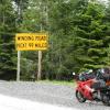
Member Contributer BonusVFR Posted March 9, 2009 Author Member Contributer Share Posted March 9, 2009 OK a teaser.................when you come to a fork in the road............take it. Yogi Zumo circa 2009. The Zumo survived. Documentation provided by a buddy!!!!!!!!! :biggrin: Quote Link to comment Share on other sites More sharing options...
Member Contributer tok tokkie Posted March 10, 2009 Member Contributer Share Posted March 10, 2009 I did something very similar on a dirt road (on a similar bike to your 'vfr'). I was very interested to look on the Zumo some days later (I was concussed & had no recollection & had to be collected by my wife from the local hospital) to see what my speed was when I binned it = 86 kph = 54 mph. Advice I had been given was gas it through thick sand so I was doing as I was told. Quote Link to comment Share on other sites More sharing options...
Member Contributer BonusVFR Posted March 10, 2009 Author Member Contributer Share Posted March 10, 2009 I did something very similar on a dirt road (on a similar bike to your 'vfr'). I was very interested to look on the Zumo some days later (I was concussed & had no recollection & had to be collected by my wife from the local hospital) to see what my speed was when I binned it = 86 kph = 54 mph. Advice I had been given was gas it through thick sand so I was doing as I was told. That is what they say.....................speed is good in the sand..................till...................... :biggrin: My shot was a result of a choice in directions..............indecision on my part and then a problem. My Navigation results off road with the Zumo have been MIXED! Hence a few lessons learned which may help with some street exploring too. Quote Link to comment Share on other sites More sharing options...
Member Contributer BonusVFR Posted March 10, 2009 Author Member Contributer Share Posted March 10, 2009 I use my Zumo on the Wing on almost every ride. On the VFR, I used it pretty much on tour. So I left the mount on the GL and switched as part of my tour preps. I have found that since I am not familiar with the dirt terrain in San Diego and the desert areas, I employ the 550 on the KLR nearly every ride. Right now, I have a hardwire to the battery but that will change with a few farkles. My usage (shifting between bikes) likely will precipitate "stimulus" change in the way I hookup the Zumo. My off road/dirt/sand navigation has not been seamless. On my recent rides in Borrego Springs for instance, I got into Nav trouble about half the time ...mostly cause I used the wrong Zumo settings and I forgot my headset adapter with meant no voice prompting even if I wanted it. I was screwed other times as there was no road on my GPS maps to where I wanted to go. Even though there were real roads. I hear even the Topo GPS maps are not much better with off the beaten track roads ....but at least you have an idea of the terrrain. Topo later too! I do remember how to use a map though and I had a lousy one of those too. On one of the dirt portions, I got away with using my standard Zumo settings but the dirt roads on the southwest portion were clearly marked in Mapsource. My tracks and route line up just about perfectly. Lucky it turns out. Although I had fooled around with the off road mode in past I did not use it .....although I should have. Here is what it looks like on the screen...imagine you are in a desert. Follow that pointer. Now here is another route that really turned to crap. You can see the route coming south but my KLR followed the biggest road (white track here) to the left off into neverland. It was not my fault! If you look from the predator drone you can see there are tens of trails all over the place and it looks obvious what to do. Unfortunately I was like a rat in a maze...could not see crap. Very few of these roads/trails were actually in the mapsource database....this is a problem. When the Zumo sees that you are off the route is recalculates (if that is what you want), but unfortunately it often tries to steer you away from the road you are on because MS does not think it exists. Confusion reigns! So you have to cut the recalc fires...to this setup. This is what it looks like following a route (sort of ) when you are not auto recalculating. I have used this several times on street tours when I was in an exploring mode and did not want to hasseled by another woman. A shot joining the route but with Topo Maps shown. Now lets say you come to gate on your route and there seems to be no dirt roads in the Zumo mapset but you are on one obviously. Turn on the off - road mode. And most importantly hope that you have cranked in some secondary waypoints on the periphery of civilization and then watch the arrows so that you are headed roughly in the right direction. Go left Boy! Next - Turning on your own tracks and using somebody else's that knows what they are doing and more about route planning. Quote Link to comment Share on other sites More sharing options...
Member Contributer BonusVFR Posted March 17, 2009 Author Member Contributer Share Posted March 17, 2009 I know that many on this site are all too familiar with GPS tracks. Probably one of the things that most annoyed dirtophiles about the Zumo was its track capabilities...it has been panned quite a bit on advrider but.............it ain't all bad. Based on my experiences alone, it almost goes without saying that one of the best ways to explore new ground is to follow somebody else’s path or in this case tracks i.e. a fellow traveler who has actually been there and done that. It is just as new to you after all. So if you follow the a track you will be fine. This can eliminate a lot of bushwhacking, back tracking, frustration with the inadequacy of GPS and paper maps and uncertainty about if there really is a way through at all. Using tracks is akin to retracing a street rider’s tour report except that you use his actual GPS position points, breadcrumbs or tracks as opposed to planned route. You could always do it your own way, chart a new course yourself and push the envelope but you could also end up in Massachusetts like the Pilgrims..and the taxes. The Zumo is one of the best GPS units out there for recording tracks as it auto stores up to 21 files of 10K points each. The Zumo has an algorithm that marks a point dependent on speed, changes of direction etc. This is a hands off proposition so you do not have to turn the tracking on or change the logging criteria when you roll from the slab to the dirt. Mostly dirt tracks in San Diego in Mapsource. All downloaded from Zumo! 50/50 street and dirt The view from the top. Pacific and San Diego on a cloudy day. Of note is that in the southern portion of this map there is no road on Mapsource..........now you know the rest of the story. Yes a poor dirt rider can get through. You can look at Mapsource all day but this tells you anybody can make it!!! This part of the trip is in Mapsource Another 100% dirt portion running up to Julian in San Diego. Zumo has a very sensitive receiver. This means you can get a fix almost anywhere...in the trees, canyons etc. You see the Zumo records everywhere dirt, street or while sampling beverages. You can play with your tracks from a ride or tour forever figuring out what you really did and how fast, high, when and where. Elevation profiles, leg speeds...great fun. Where was that photo anyway? Check the time stamps and compare ...watch the time zones. The Zumo records tracks with the best of them. I figure I can ride for about two months straight and still be recording…but who is counting. The Zumo can also display about two days of your own tracks (10K) on the GPS screen so if you get lost you can display your tracks magenta line and follow them out. Here you can see several sets of tracks displayed on the Zumo screen. However much of the criticism of the Zumo from off road purists has centered on its inability to display third party tracks or even your own tracks in different colors. Following tracks has been adopted as the way to promulgate and follow the path to the promised DIRT land. The Zumo uses a different protocol to display other folks or your old tracks…namely it converts them to route. You can either do that from the current active log (about two days worth or 10k points) or import them from MS or a SD card to the Zumo. When the tracks are uploaded to the Zumo it auto converts them to a route. So when you follow somebody else's tracks on the Zumo you are actually following tracks that have been converted to a route. But you can do it. Here my tracks converted to route which I am following. There is no road in the Zumo/MS mapset shown here even there actually is one now. If you want to reverse a route it had best be done in MS as doing it on the Zumo is problematic. And following a route the wrong way on the Zumo can be troublesome…try it you will not like it. You can follow your displayed tracks either way. Unlike some GPS unit that can load and display multiple set of tracks the Zumo can only display one route at a time. But you could combine multiple routes and have a waypoint announce “starting part two” or some such drivel. You can import up to 50 routes in the Zumo so there is no practical limitation as you can store whatever you like on the SD card and then import them as you need em. Here are is a route converted from Tracks near Borrego California. The tracks in Topo ...........road here but not on City Nav maps And there is a road but that does not mean it will be on a map! Next a couple of notes on the track to route conversion process ....differences between street and dirt conversions. And remember that Mapsource and the Maps are really too different animals and both need updating...but you use Mapsource to look at your maps and monkey with your routes/tracks on the PC. Quote Link to comment Share on other sites More sharing options...
V4 Rosso Posted March 18, 2009 Share Posted March 18, 2009 I was screwed other times as there was no road on my GPS maps to where I wanted to go. Even though there were real roads. I hear even the Topo GPS maps are not much better with off the beaten track roads ....but at least you have an idea of the terrrain. Topo later too! Depends on where you live as the Topo maps I have are very detailed. It shows every track but the singletracks made by wildlife. It is about as detailed as military maps. Currently the Topo maps are not routeable but that will change within as within a few months, maps specifically targeted at hikers will be made avialable. Last weekend I was my brother's navigator in a nightly classic car rally. You navigate using the notes that are handed out just prior to the start. Using maps or a GPS is useless. Still I had brought my streetpilot with me to record the track for later review because I am just curious to know where we had been. Also there were some great twisty bits that seemed liked fun to ride on a motorcycle and all I had to do was to make a note of the time and use the tracklog to see what road it is :idea3: Quote Link to comment Share on other sites More sharing options...
Member Contributer BonusVFR Posted March 18, 2009 Author Member Contributer Share Posted March 18, 2009 V4Rosso ....who makes your Topo mapset and how much area does it cover? My Top experiences have been mixed but on balance a big plus. And my digital maps are free! Topo is not a panacea but another big aid along with the City Nav maps in the Zumo. My foray into Topo has put me on a steep learning curve and I suspect I will be trying out different topo maps. More later on Topo! My California Topo maps for instance did not register this little ditch last weekend ......Death Valley. Turns out no National Park data in my California Topo mapset. Quote Link to comment Share on other sites More sharing options...
Member Contributer BonusVFR Posted March 20, 2009 Author Member Contributer Share Posted March 20, 2009 Garmin has two Topo types high & low res basically that cover a variety of areas with high & low price points. There are also high res National Park Topos. After seeing screen shots on a couple of jeep threads, I thought the high res would work better for me. While I was investigating the Garmin Topo maps, a KLR rider (Scorpio) suggested I check out these California 24K topo maps. Oh .........they are free. Took me a while to get them on the PC and the Zumo. http://www.gpsfiledepot.com/maps/view/28 I ended up downloading from the source Laura Sanborn to get them on a SD card. http://www.vr6.com/gps/map-bg.htm Mapsource allows you to instantly switch between City Nav and the Topo. You can pull up a route or tracks and instantly see the difference between the mapsets. This is very handy for dirt or back road trip planning and post mortems. Now where was I exactly? A couple of points on my dirt routing that I may not have emphasized enough. When I build off pavement routes, I NOW tend to build more waypoints that are not real stops but nav prompts instead of using my usual shaping points. I pretty much use shaping points exclusively on street tours. I throw in random steets waypoints not in the routes but as maybes. For me, waypoints have an even greater advantage off road especially on the topo maps because the flags stand out in the clutter. Much easier to to find your bearings that way..so my thinking on waypoints off road is morphing. Despite the fact that the routes with waypoints download the waypoints too, I still download all waypoints as well (route and non route). When your route goes to hell due to a fence/house or something odd you can route directly to a waypoint and find an alternative way if there is one. I will probably will come up with some naming convention that makes it easier to quickly sort out the order of the waypoints on the route. LawsonValley1, LawsonValley2 etc. Lawson Valley Some Topo shots. Recalc is off here and I am rejoining route after a few detours. Note the waypoint flag which is easy to see. Really gives you a sense of the terrain. Crossed a stream...yup and rejoining the route again. Steep bank to the left and a stream to the right...topo checks out ...the screen capture was taken on the return leg a few yards from the photo My number one Navigation problem...........kinda reminds me of a reef in my Navy days. I see more of this on the topo. A little bit off road. But there is no place to go once off the trail. About 2960 feet........really. Compared to the City Nav map. Look how accurate the elevation profiles are though. Hardly worth looking at the altimeter screen. This is based on a sample size of one.... In this shot you have my tracks on the topo screen. This screen dump shows more roads than there actually are too. Besides the National Park issue in the thread above...............don't bother looking for gas.................gotta go back to the City Nav. Quote Link to comment Share on other sites More sharing options...
V4 Rosso Posted March 22, 2009 Share Posted March 22, 2009 V4Rosso ....who makes your Topo mapset and how much area does it cover? The topo maps I have are a Garmin product but I do not know where Garmin gets their data from. Topo maps are available per country and some are quite expensive, e.g. the Swiss maps are like €340 :happy: There are third party maps available for Garmin GPS systems as there is Onroute for cyclists that contains most of the fine maze of bicycle roads we have here, so you can plan a bicycle trip using mapsource just like you do with the city navigator maps. In a few month a similar product will also be available for hikers, so that means routable topo maps (1:25.000). Onroute's first product was a trip planner aimed exclusively at motorcyclists. It contains routable maps for all of Europe with more differentation between various types of roads. It also has a very extensive POI database with e.g. motorcycle friendly hotels, camp sites, motorcycle dealers and tracks. It also differs in trip planing from Mapsource in that it not only can calculate the shortes or fastest route, but more scenic routes that have roads leading alongside rivers, through forrests, over mountain passes and have the most curves per mile. It also can plan loops. You just have to point it a certain address and tell it how long a loop you want and it will calculate a nice trip to upload to your GPS. Another nice feature that this software has and I would like to see in mapsource is that it can show a selection of POIs (e.g. restaurants, gas stations) that are on or very close to the planned route. The next version will have maps that can be uploaded to Garmin GPS units. The current version can export a route to a Garmin, TomTom or NaviGon GPS. You can also export route descriptions and maps (as images) to handheld PCs. It is so extensive it comes on a dual layer DVD and takes up nearly 8GB of HD space. the pic below is a screenshot of the interface: On the left the route description and a graph showing the elevation changes, in the middle the map with the plotted trip and POIs that are selected using the quick select buttons shown in the bar on the right of the screen. Quote Link to comment Share on other sites More sharing options...
Member Contributer BonusVFR Posted March 24, 2009 Author Member Contributer Share Posted March 24, 2009 I had to shoot over to Las Vegas on business ..................scored a new low for me. Thankfully I avoided any congressional staffers so I will not have to testify. On the way back! Only Badwater is lower. On the way out. Glamis California. Quote Link to comment Share on other sites More sharing options...
V4 Rosso Posted March 24, 2009 Share Posted March 24, 2009 That last pic is both funny and beautiful. It would make for a nice wallpaper if it didn't have the date printed on top. Quote Link to comment Share on other sites More sharing options...
Guest TheJarmanator Posted May 3, 2009 Share Posted May 3, 2009 Thanks for the details about mounting the Zumo onto your VFR. I got my Zumo back in September last year for my Deauville; this followed a relocation to Scotland, which is great biking country. After 27,000 miles with the bike, over nearly 10 years, I have decided to upgrade to a VFR800-ABS VTEC. This was reluctant at first, because I prefer the low maintenance of shafts, however since my biking is now purely for pleasure I have returned to chains after 25 years of shafties. I prefer the look of your tank mount, so have just ordered the RAM mount (RAM-B-231) which you described perfectly. Finally, though very costly, I have personally found that the Zumo is excellent for biking - especially the post-ride analysis of where you went. Due to the mountains around here, the altitude graph is always an interesting thing to look at; especially during my last ride, which was a 338 mile round trip one afternoon. I also use the Zumo in the car, and find it makes an excellent hands-free system for my mobile. Keep on riding :cool: Quote Link to comment Share on other sites More sharing options...
Member Contributer BonusVFR Posted May 6, 2009 Author Member Contributer Share Posted May 6, 2009 Since the dual sports seems to do so well in the second bike poll.............more on my dirt woes. Well I have had a chance to get dirty with the Zumo a little bit more. I seem to need more rest off road. :biggrin: First I did a ride to the Mexican Border over uncharted city streets, unmarked river valley, new unmapped dirt roads, mapped dirt roads and open terrain by the future USA border fence. My goal was to get a better handle on the Zumo Off Road Mode which I never have felt comfortable with. For at least half the route I used my tracks from a previous ride. After a little track editing I converted the track to a route with the Zumo upload process. These converted tracks were obviously mixed ....some street or mapped and some pure offroad or unmapped anyway. My plan was to wander off the track conversion and observe closely what happens with the off road mode. Here are the tracks of the actual ride. The border not far from San Diego...believe it............we were the only ones there including those swine pig things! Next the experiment. Quote Link to comment Share on other sites More sharing options...
Member Contributer BonusVFR Posted May 7, 2009 Author Member Contributer Share Posted May 7, 2009 In the last 5 months I have done quite a bit of KLR exploring/off-paved streets with the Zumo 550. However much of the time I have been on mapped dirt roads. I have found my Zumo setup varies depending how screwed up/lost I get or when I want to head back to home/camp. The Zumo setup is really a work in progress with almost new insights on every ride. When I download a dirt route (planned in Mapsource/Topo) or do a track conversion, I generally set my preferences to not recalculate but leave faster time instead of the off-road mode. I can see if I am on route and manually correct and guide over to the route visually. As I stated earlier in this thread, I have found recalculating routes off road can be a disaster as the dirt road db is problematic so the Zumo goes crazy as it may or not appreciate that you are on a dirt road even if you are. See my Borrego picture earlier in the thread. Off road mode routes with arrow direct to the next waypoint as described in the manual - over hill and dale to be sure. If you have a lot of waypoints on your route this is ok but I often do not. The problem lies in the fact that when you convert to a route from a track the Zumo basically uses a different algorithm dependent on whether a mapped road exists where you have been and so the off road mode works differently. Off road mode has been handy a few times to point me in the right direction........but best to have several waypoints cranked in if not on the route ..............to the edge of civilization. Much easier that looking for and squinting and punching by hand destinations under the hot sun. In this test, I set the Zumo to Offroad mode with Recalc set to off. I loaded my mixed terrain route into the Zumo and headed out. There were no waypoints in my route per say…just my tracks from a previous ride. First thing you can see here is that I am off route and not on a mapped street and you can see the arrow is pointing at the closest point on the route (actually a viapoint part of the track conversion process when there is no actual street)…………..not to the end of the route or the destination. And it is a point as there is no underlying street to factor in. The arrow is helpful and guides me quickly back to the route. You can still see my old tracks on the conversion route too. Now I am actually going up the previous tracks and the distance to the next turn/point is marked on the screen. Again there is no underlying road on the map set…………….. Go East 400ft and I am just following the road not turning off of it. Go East 500 ft etc. You can see that the route faithfully follows the old tracks Here is the road I am actually on ....actually upgraded quite a bit for use by the Border Patrol……………..just not in the map set yet until City Navigator 2017. But it does appear in CN about half way up the mountain. Now when the road appears on the CN map set you get this…………..same damn road. You get a name - Otay Truck Trail - and note how the distance goes to the end of the route here as there have been no intermediate waypoints put in by the track conversion algorithm. And my old tracks do not necessarily follow exactly the route...............because the route conversion used the actual road. I could not go off the route here as I would have dropped 2000 ft to the bottom of the ravine. Here is the Zumo conversion route downloaded back into Mapsource……………..you can see the transition from viapoint generated route to road based route. Blow up the shot if you need too to see the viapoints on the west side of the route till the road on the map appears. In this case Topo and City Nav agree although they are both wrong/out of date. So if you have a mixed route of pure off-road and mapped sections you will not see consistent indicators on your Zumo not matter how much dirt there is! Here is a clear example of the downside of off road mode. Say you had a day of it and the exploring is over and you want to get back to the barn or campsite. I am still in off road mode here. If I punch a town on the periphery of civilization, you get the arrow direction direct to Dulzura in this case. Yes over that little hill. Guess I do need the knobs. Better to be in faster time or shortest distance mode in this case as the dirt road obviously is in the map set, and route using the roads would be cool and no doubt faster especially if you are tired and not skilled (see KLR resting shots). Of course If you are in off road mode you can still get there but have more Zumo steps ie select shortest distance or time modes and then punch in a favorite/waypoint. So there is no silver bullet.................you pick the best mode for the situation. Judgement. You have to use your wits which is a problem if you are a half wit like moi............but I actually enjoy the Zumo interactions more off road...more of a challenge. I am always trying to figure out the best way to optimize the scenario. Hopefully this helped ...........at least to start you asking more questions. You can still wing it but perhaps even more route planning is required, but no such thing as a perfect plan. It has been fun...............more experiments to follow. Quote Link to comment Share on other sites More sharing options...
Member Contributer BonusVFR Posted May 16, 2009 Author Member Contributer Share Posted May 16, 2009 Going back to the issue of downloading tracks ..........especially for off road routes, you have got to check the tracks out. And there is that pesky offroad problem of the ~ 250 point limit with the 550 (fixed with 660 I hear). I do not think it is good enough just to check tracks out on the Zumo. It is too much of a PITA to to blow up and review a 10 mile route. Really you have to zoom/check them on the PC. Off road, I find myself going down dead ends, finding stinking gates, water holes or impenetrable minefields and oh yes naps. All of these can create a bunch of extra and misc crap tracks and diversions. The only way to eliminate these is to blow them up in mapsource and sh... can them. Sanitize, clean and join on the PC! For other GPS units that mark points in a deliberate way you can also filter the tracks to reduce the number of points but the Zumo already has an excellent routine to optimize point placement so there is not a huge performance gain here . Sometimes it is a good thing to also check out the converted route too as the conversion is not always perfect. You can see here the route does not follow the track as I did a 180 cut back very close to the original track Quote Link to comment Share on other sites More sharing options...
Member Contributer BonusVFR Posted August 12, 2009 Author Member Contributer Share Posted August 12, 2009 For my recent BC tour, I loaded my Zumo with a crap load of extra POIs. I had some 30 databases from campgrounds, parks, MC dealerships, fleabag hotels, Walmarts, coffee/internet to VFRD destinations (Thanks HS). Most came from POIfactoy.com . The Zumo OEM database is pretty sparse with campgrounds for instance so adding adding custom POIs gives more options. Here are a few screenshots. Here is a shot which really shows the advantages of the POIs and the symbols.................imagine you are looking for a campground. This road is in California but you get the point. Makes it really easy to pick them out! And then just touch the graphic and route. In your POI directory on your PC, you should only have one sublevel so do not have separate directories for example like Motel 6, Super 8 etc. Just put them all in a Hotel sub directory. Make sure you name the graphics with the same file name. I did not look to see if this was in the Garmin DB, but I am sure it is even if it is not Tour Eligible.........................maybe when I step up to a 7th gen. :blush: :blush: Better view though perhaps than a Motel 6 ....you think. And of course with any DB you could roll up and see this. Quote Link to comment Share on other sites More sharing options...
Member Contributer BonusVFR Posted September 5, 2009 Author Member Contributer Share Posted September 5, 2009 For those of you who never really clicked with Mapsource .....................there is perhaps another option with the new version 2010 of Street and Trips. It now has GPX support. I still use the S&T Product for the Master Plan ...........I certainly will upgrade this year to the 2010 S&T........maybe even with a Sirf GPS unit. Some of the new features: Microsoft provided a list with the features that Street and Trips 2010 brings to the table: “- New map data from NavTEQ - a world leader in premium-quality digital map data and content. - 348 pushpin icons! (back by popular demand) - Ability to share data with your Personal Navigation Device (like your Garmin) - Full GPX support (import and export) - Click'n'Drag rerouting - Improvements to help with pushpin management and control - Return of the Back (and Forward) functionality - 5 new POI (points of interest) categories - Ability to copy latitude and longitude coordinates to your clipboard (ctl+alt+c) - Ability to rename your route waypoints - Ability to show or hide individual pushpin sets - Displays the distance to your next stop as well as your destination - Ability to search for Highway Exits - Easy customization of your map view - Ability to pause Windows Media Player during spoken instructions = Plus numerous other improvements, tweaks and bug fixes.” From the MSFT site New!―Save time by setting your map to always start at a particular location. New!―Share trip details or itineraries with friends and family. New!―Send your route to your GPS device. New!―Easily delete or hide groups of pushpins. Improved!―Choose specific roads to use on your trip just by dragging and dropping the route. Improved!―Streets & Trips now includes more than 300 unique pushpin images to choose from. Improved!―Comes with more than 1.7 million points of interest including post offices, pharmacies, and more. Quote Link to comment Share on other sites More sharing options...
Member Contributer BonusVFR Posted October 5, 2009 Author Member Contributer Share Posted October 5, 2009 Well I have been doing some touring on my Wing and VFR but...........recently I have been using the Zumo/KLR for more dirt stuff as the weather has cooled a bit. Lots of dirt road stuff by the border................and with the Zumo I have experienced the first really weird behaviour from my machine. Turns out if you do not clean your screen routinely dirt/dust/sand gets caught in the bezel on the outside of the screen. Sometimes this will cause the touch screen to act up. Solution - Wash the corners or use a business card/something similar to get the crap out. A certain sign is if you get a warning on start up ..."Do you want to erase all data" or you seem to be punching in different letters in than you thought you touched. Screen may require recalibration too which is described in the manual. Another indication that your screen is dirty is if your camera is clogged toooooooo! The whole cleaning thing is antithetical to a KLR rookie but a guy has to do what he has to do! :happy: Quote Link to comment Share on other sites More sharing options...
Member Contributer hondalover Posted October 5, 2009 Member Contributer Share Posted October 5, 2009 I wonder if that was my problem. I had just under 20K miles on my Zumo without a hiccup, then at the Sum. Sum. it erased my Steamboat Springs route and continually got worse. By the time I got home from that trip, the GPS was about worthless as far a navigation goes. You couldn't press the correct button, and often times it pressed buttons on its own. My new Zumo should be on the way from Garmin. I wish you would have found this out about 6 weeks ago. Quote Link to comment Share on other sites More sharing options...
Member Contributer BonusVFR Posted October 5, 2009 Author Member Contributer Share Posted October 5, 2009 I wonder if that was my problem. I had just under 20K miles on my Zumo without a hiccup, then at the Sum. Sum. it erased my Steamboat Springs route and continually got worse. By the time I got home from that trip, the GPS was about worthless as far a navigation goes. You couldn't press the correct button, and often times it pressed buttons on its own. My new Zumo should be on the way from Garmin. I wish you would have found this out about 6 weeks ago. The story of my life ..............a day late and a dollar short! :blush: :happy: My problems started with "getting dirty". How did that happen? Quote Link to comment Share on other sites More sharing options...
Member Contributer hondalover Posted October 6, 2009 Member Contributer Share Posted October 6, 2009 Yeah, I try to keep my bike clean most of the time. Those drive-thru washes work great. Quote Link to comment Share on other sites More sharing options...
Member Contributer jasonsmith Posted November 4, 2009 Member Contributer Share Posted November 4, 2009 (edited) I Picked myself up a 660. Here are some pics. More screenshots in my gallery for those interested. Box Map DVD Motorcycle Mount Car Mount Zumo in case Edited November 4, 2009 by jasonsmith Quote Link to comment Share on other sites More sharing options...
Member Contributer NorthernVFRDave Posted November 4, 2009 Member Contributer Share Posted November 4, 2009 660 looks nice :fing02: I'm thinking about swapping out my 450 in the new year. But may hold out and see if they bring out a 660 with with SiriusXM like the 550. Everyone I have every talked too questions why Garmin dropped this. Quote Link to comment Share on other sites More sharing options...

Recommended Posts
Join the conversation
You can post now and register later. If you have an account, sign in now to post with your account.