
Finding The Back Way To Salida
Entry posted by HispanicSlammer
2,766 views
Skyline Drive
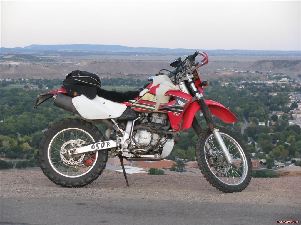
I once took a dirt road from hwy 9 last summer just to see where it went, along the way I passed a road that headed west and there was a sign that said "Salida 40 miles" I did not have time to explore it, instead I was looking for back way into Cotopaxi, which I never found. I was on some forgotten dirt road some developer had cut for houses that never got built. It ended and I had to turn back. I never forgot that sign though and though well "some day"! Last tuesday was the day, and after looking at the map I found it was named "ute trail" so I packed my tail bag, aired up the tires on the Big Piggy, topped up the motor oil and headed up Old Stage road to Salida.
Cripple Creek
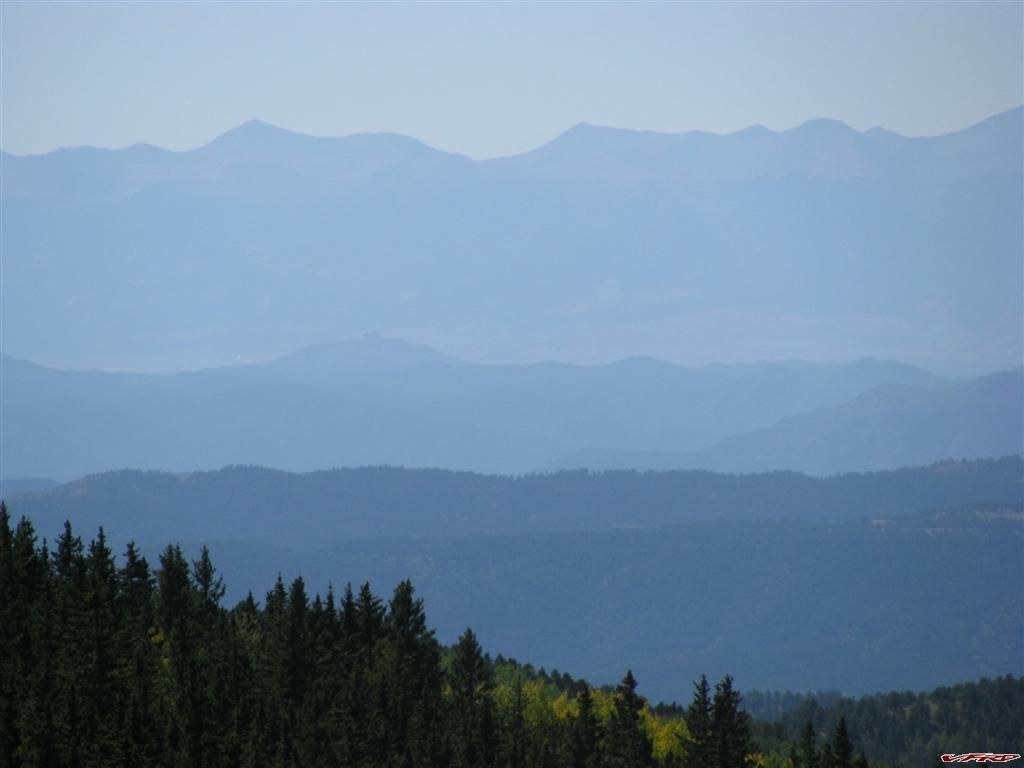
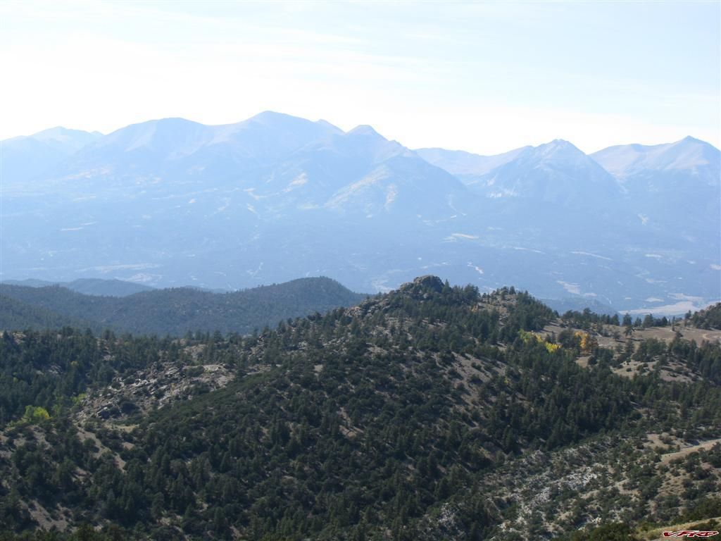
Sangre De Christo Mountains in the Distance
Aspens Changing above Cripple Creek
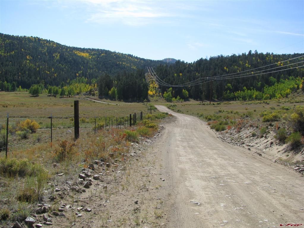
I was getting my fillings knocked out of my mouth from the bone jarring waves of bumps that happen on the downhill sections where the grader had once smoothed out the road but the rain had made a nice row of shallow bumps. It makes my teeth nash together so I jumpped off and softened up the rebound a bit on my shock. It worked but then my bike was a bit bouncy on the pavement. I would say all in all I did 40 % dirt 60 % pavement on this ride.
riding from Cripple Creek to Guffy was all pavement and surprisingly I was going faster than most the cars even with my back end bouncing around when I turned hard, I passed a mess of cagers going down hill to the High Park road turnoff, and then I was soon on the roller coaster we call High Park Road. Its fun but dangerous cause its open range and cows like to stand in the middle of the road. You have to slow down on the crest of the hills or you could plow into one on the blind downside! A woman riding with our local sport bike group lost her life there 3 years ago doing just that!
Anyway I tunrned toward Guffy and headed west all alone at this point, seems nobody goes to Guffy anymore, all the resturants were closed and up for sale, seems the place is abandoned all except for the antique stores. We used to stop there for a drink on the way home from Hwy 9, then short cut over to Woodland park. Not anymore the resturant is closed now.
I headed north west on hwy 9 till I found the turn off a couple of miles down the road to get to Ute Trail, a dried up mudd road called co-88 it was full of mud ruts and somewhat tricky to handle, I turned west on what I thought was the trail but ended on some private road. I turned around and headed south again to Stirrup Ranch where Ute Trail picks up. I thought I was alone so I was riding somwhat slow. I saw the horses at Stirrup ranch and took a picture turned around to see a huge ford Bronco right behind me, oops didnt hear them or seem them way out here. They stopped and asked me what I was doing, I guess they saw me turn off on that private road and were watching me - I did not think I was tresspassing but those cowboys were a bit cautious about me. I just said I missed the turn and then saw the sign and turned back onto the road. "I just got lost for a mile or so thats all". They offered me a cup of coffie which I declined and they pointed me to the correct road to Salida. Thanks apparantly some folks have been trespassing on thier land and dumping trash. I guess I can understand where they where comming from, I saw the sign and went no further, turned back and got back on CO-88 - so they followed me to make sure I got out. Co-88 goes into private land but the road is a public road.
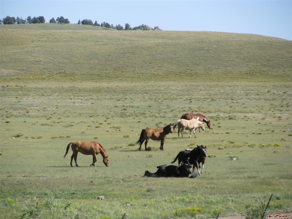
Horses at Stirrup Ranch
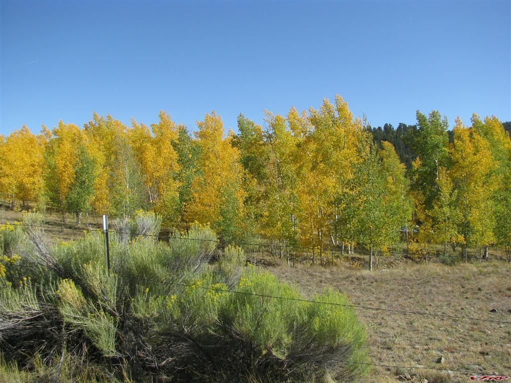
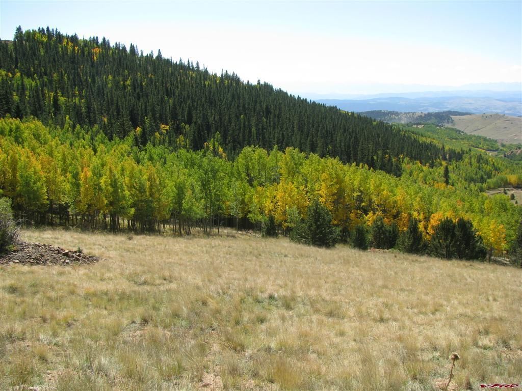
Aspens Changing at Mud Creek
Whitehorn CO
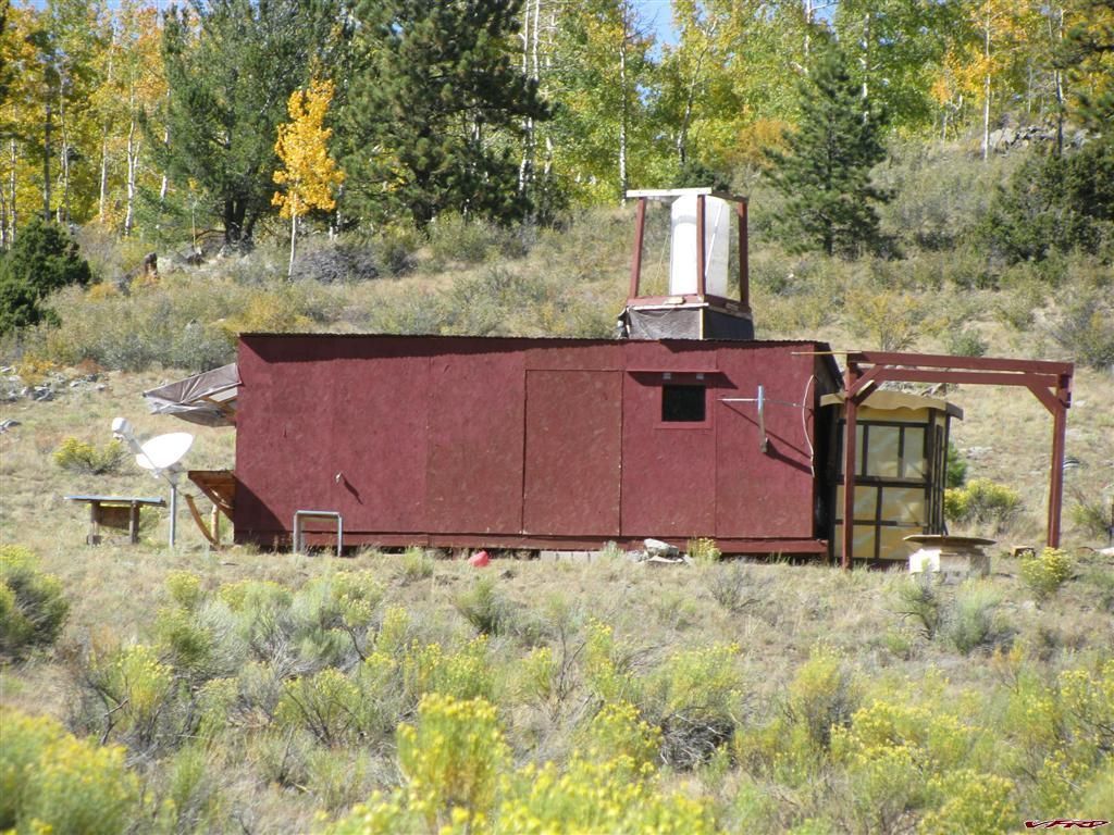
All the Essentials Satalite T,V Shower, Hole in the ground - an outdoor paradise!
Once on the Ute Trail they followed me some more but I was aware of them now and just twisted the trottle and left those cowboys in the dust, I was all the way at the bottom of the next valley before I saw them top the hill I had just come, by the time I was past the next valley I was long gone. I found a strange shack out in the boonies near Whitehorn, it was just particle board painted red and slapped up like an old box car, there was a tower with a 50 gallon water tank on top for showering I guess and a hole in the ground for when nature calls. It was definitly crude, but they had a satalite dish!! HEH
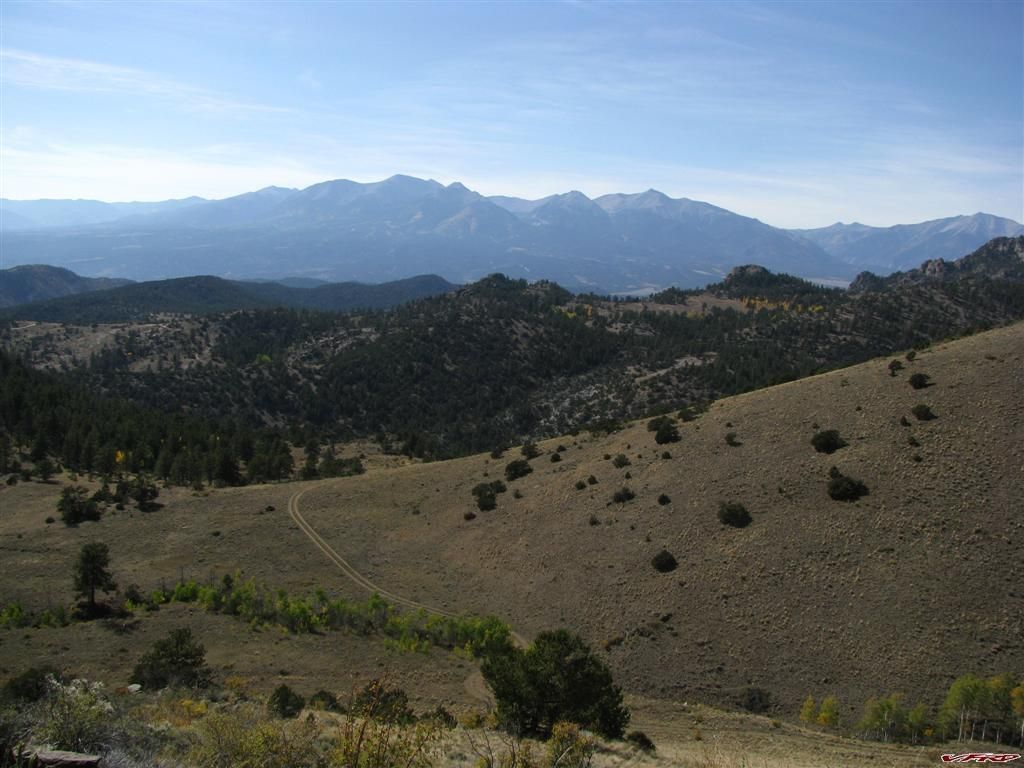
I was soon into the mountains around Salida and heading down the Pass on Ute Trail where I was witness to a breathtakeing view of the Collegiate Peaks across the valley.
Ute Trail - Salida Colorado
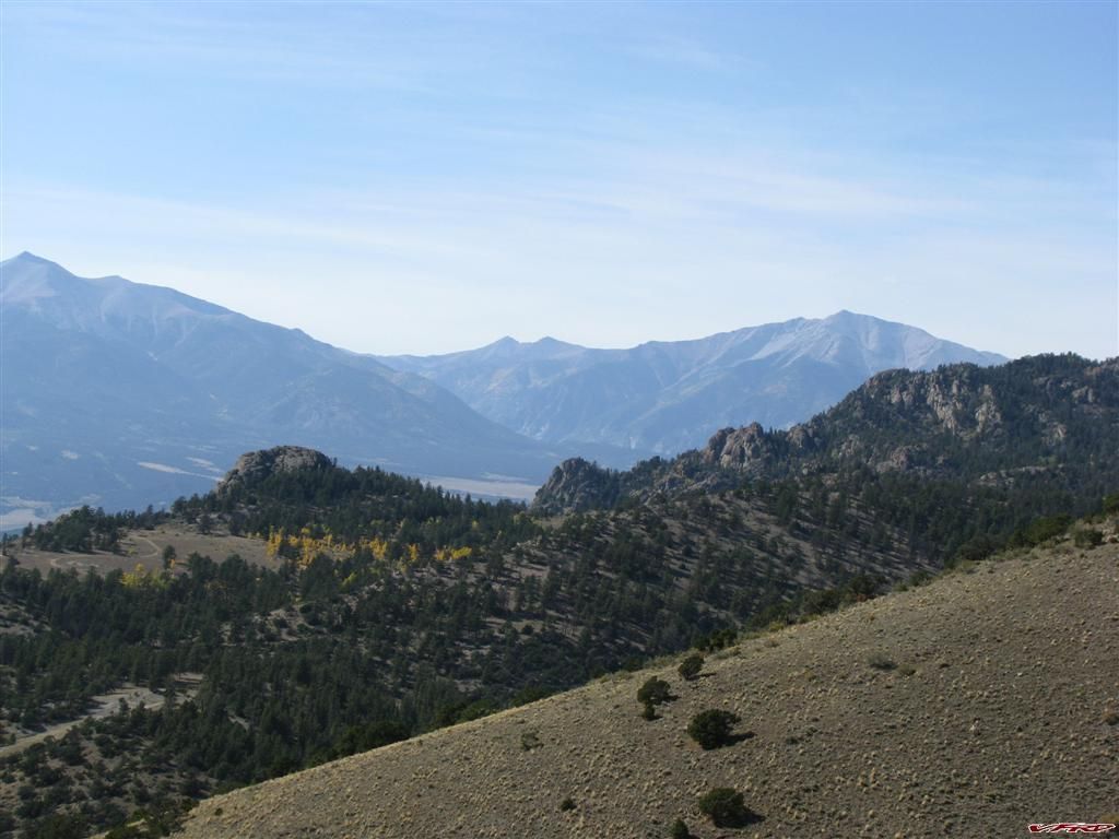
Ute Trail - Salida Colorado Mt Antero and Mt Princton
Ute Trail - Salida Colorado Collegiate Peaks
It was 112 miles on the trip meter at this point and my 4 gallon tank was getting low, I am sure I can go alot further but the plastic tank is sort of divided by the frame, and so I would have to syphen the gas from one side to the other once it gets too low. I stopped at a gas station and filled up. Some construction workers where sitting on the bench and waved hello, I went inside and got a cold drink, came out and they where having a full blown shouting match about which was more powerful, a 450 4 stroke or a 250 2 stroke? Heh it was funny I just kicked the bike started and headed into town to the 1st Street Cafe. A Black Labrador Retriever greeted me at the door and I sat down at a table where I could observe my bike, I had forgotten to bring a lock! The house specialty was jerk chicken with sweet potato fries and cole slaw on the side. The chicken was tender and the jerk sauce dip was spicy enough to make me cough! The sweet pototao fries where a bit too much for me though - the flavors in combination was a bit overpowering and it left me a little unsatisfied with the meal, and I hate cole slaw, expecially since they seemed to have added horse radish to the slaw! I ate it all up though cause I was really hungery! I had not ate all day!
I headed east on hwy 50 to Cotopaxi behind a guy on an old yamaha crusier, inline twin - no gear at all and he was going around 70mph in the sweepers, my boucy shock was leaving me feeling a bit too unstable and he got away from me - if I was on the VFR however he wouldnt have seen my taillights for more than a few seconds before then cause I routinely ride that section at 90+ one handed and ready for sleep! Oh well Cotopaxi came up soon enough and I stopped at the general store and got some beef Jerky cause I was still hungary. I though ok now I am going to find that elusive back way to Ute Trail from here! rode strait north and the pavement went on for at least 15 miles, which surprised me! I thought as soon as I got past the town it would turn to dirt! then I found a fork in the road, one said Salida 25 miles and the other said Mt Wudiga so I took the Mountain road! past about 12 deer feeding on the weeds and headed up the hill. then the road got worse for wear and it was definitly dirt, and I saw a No Tresspassing sign! Shoot I guess I could head back to that fork in the road and head for Saliada, cause I saw where it came out by that strange shack a few hours back but that puts me too far west on Ute Trail I would have to back track some 60 miles? It was getting late and I did not want to be one some strane road so I went all they way back to Cotopaxi and took hwy 50 to Cannon City!
Canon City well I might as well go up Skyline Drive and watch the sun go down!
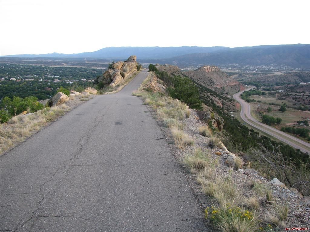
Skyline Drive
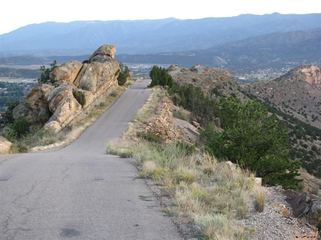
Skyline Drive Canon City Colorado
Skyline Drive
THE MAP
Attached is the gps tracks and a google earth file of the path
1 Comment
Recommended Comments